
IMAGES TAKEN NEAR TO
High Street, BURY ST. EDMUNDS, IP28 6SA
Introduction
This page details the photographs taken nearby to High Street, IP28 6SA by members of the Geograph project.
The Geograph project started in 2005 with the aim of publishing, organising and preserving representative images for every square kilometre of Great Britain, Ireland and the Isle of Man.

There are currently over 7.5m images from over14,400 individuals and you can help contribute to the project by visiting https://www.geograph.org.uk
Image Map
Images are licensed for reuse under creativecommons.org/licenses/by-sa/2.0
Notes
- Clicking on the map will re-center to the selected point.
- The higher the marker number, the further away the image location is from the centre of the postcode.
Image Listing (39 Images Found)
Images are licensed for reuse under creativecommons.org/licenses/by-sa/2.0
Image
Details
Distance
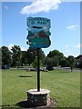
1
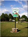
Tuddenham St. Mary village sign
Buried treasure! There is a time capsule under this village sign.
Image: © Mike W Hallett
Taken: 5 Jul 2009
0.02 miles
2
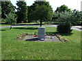
Memorial to 90 Squadron
Memorial to 90 Squadron R.A.F. Tuddenham Suffolk.
Image: © Keith Evans
Taken: 30 Jun 2008
0.03 miles
3
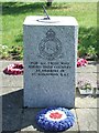
Memorial to 90 Squadron
Memorial to 90 Squadron R.A.F. Tuddenham Suffolk. For overall view see http://www.geograph.org.uk/photo/866164
Image: © Keith Evans
Taken: 30 Jun 2008
0.03 miles
4
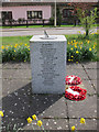
RAF memorial, Tuddenham
Image: © Hugh Venables
Taken: 3 Apr 2011
0.04 miles
5
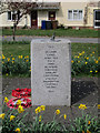
RAF memorial, Tuddenham
Image: © Hugh Venables
Taken: 3 Apr 2011
0.04 miles
6
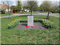
RAF memorial
Memorial to 90 Squadron RAF on the village green in Tuddenham. There were many airfields in this area during WWII as the area was flat, away from large cities, generally low grade for agriculture and not too far from the North Sea coast. See Image] and Image
Image: © Hugh Venables
Taken: 3 Apr 2011
0.04 miles
7
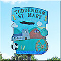
Tuddenham St Mary village sign
Starting from the top, the sign displays two sheaves of corn, representing the agricultural heritage of the parish. The aircraft is a reminder of the airfield during the Second World War up to 1963 when it was home to various bomber squadrons and later to Thor missiles. The church of St Mary and a modern tractor ploughing a field brings agriculture into the modern day. The football and cricket paraphernalia represent local sport and the playing field. The watermill which was built in 1775 and was worked until 1954. It remained derelict until 1972 when it was converted into a restaurant, retaining the working water wheel as a feature. https://www.geograph.org.uk/photo/4295584
Image: © Adrian S Pye
Taken: 28 Jul 2007
0.04 miles
9
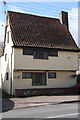
Old cottage in Tuddenham
This cottage is dated 1581 and is situated opposite the Green in the centre of the village.
Image: © Bob Jones
Taken: 9 Mar 2009
0.04 miles
10
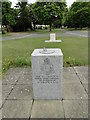
The RAF Tuddenham Memorial
- with the village War Memorial in the background.
Image: © Adrian S Pye
Taken: 26 May 2015
0.04 miles