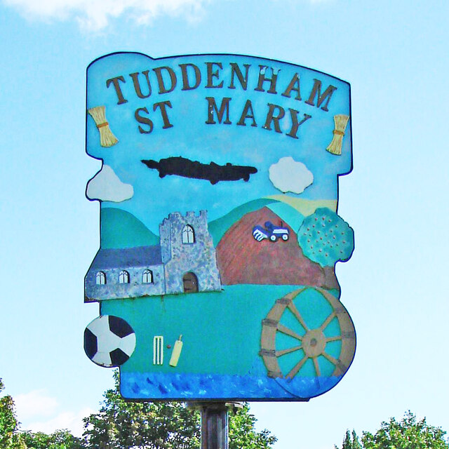
Tuddenham St Mary village sign
Introduction
The photograph on this page of Tuddenham St Mary village sign by Adrian S Pye as part of the Geograph project.
The Geograph project started in 2005 with the aim of publishing, organising and preserving representative images for every square kilometre of Great Britain, Ireland and the Isle of Man.
There are currently over 7.5m images from over 14,400 individuals and you can help contribute to the project by visiting https://www.geograph.org.uk

Image: © Adrian S Pye Taken: 28 Jul 2007
Starting from the top, the sign displays two sheaves of corn, representing the agricultural heritage of the parish. The aircraft is a reminder of the airfield during the Second World War up to 1963 when it was home to various bomber squadrons and later to Thor missiles. The church of St Mary and a modern tractor ploughing a field brings agriculture into the modern day. The football and cricket paraphernalia represent local sport and the playing field. The watermill which was built in 1775 and was worked until 1954. It remained derelict until 1972 when it was converted into a restaurant, retaining the working water wheel as a feature. https://www.geograph.org.uk/photo/4295584

