1
Fornham All Saints Church
Just north of Bury St Edmunds, this church is much older than it looks.
Image: © Bob Jones
Taken: 22 Jun 2005
0.02 miles
2
Village Hall, Fornham All Saints
Seen here during the annual Scarecrow Festival fundrasing weekend of activities.
Image: © Stuart Shepherd
Taken: 15 Jun 2009
0.02 miles
3
Fornham All Saints: House in Forge End
Image: © Michael Garlick
Taken: 13 May 2021
0.05 miles
4
Fornham All Saints: Private well
Image: © Michael Garlick
Taken: 13 May 2021
0.06 miles
5
Fornham All Saints: Forge End
Image: © Michael Garlick
Taken: 13 May 2021
0.07 miles
6
Road junction at Fornham All Saints
At this point the A1101 Bury St Edmunds - Mildenhall road meets a B road running from Westley - Great Barton. The number of the B road seems to be a matter of confusion; maps - including the Ordnance Survey - show it as the B1106 (which is also the Bury St Edmunds - Brandon road) but Suffolk County Council and its road signs have it as the B1066 (which is also the Long Melford - Horringer road). There is a war memorial on the corner.
Image: © Stephen McKay
Taken: 6 Dec 2009
0.07 miles
7
Fornham All Saints War Memorial
There are 12 names from WW1 on the memorial and one from WW2. WW1 Casualties: T. HART, W. HART, W. HARVEY, R. LEGGETT, G. LILLEY, E.L. MACKMURDO, E. MURRELL, G. MURRELL, S. RAYNER, S. SCOULDING, G. SMITH & F. TURNER. The single WW2 Casualty was R.C.G. RAYNER.
Image: © Adrian S Pye
Taken: 18 Mar 2015
0.07 miles
8
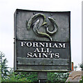
Fornham All Saints village sign (reverse)
A dark unpainted sign depicting crossed swords and a steel helmet commemorating two battles which took place here. In around 902 King Edward fought off a cousin to retain the English crown and in 1173 Henry II defeated the Earl of Leicester and a Flemish army at the Battle of Fornham. The fish on the reverse are trout and are there because the word Fornham means 'trout village' derived from the old English words forne and ham. https://www.geograph.org.uk/photo/4292707
Image: © Adrian S Pye
Taken: 19 Dec 2020
0.08 miles
9
Fornham All Saints village sign
A dark unpainted sign depicting crossed swords and a steel helmet commemorating two battles which took place here. In around 902 King Edward fought off a cousin to retain the English crown and in 1173 Henry II defeated the Earl of Leicester and a Flemish army at the Battle of Fornham. The fish on the reverse are trout and are there because the word Fornham means 'trout village' derived from the old English words forne and ham.
https://www.geograph.org.uk/photo/6753472
Image: © Adrian S Pye
Taken: 25 Aug 2008
0.08 miles
10
The church, Fornham All Saints
Lying on a turn in The Green, the main road of the village.
Image: © Carl Grove
Taken: 13 Apr 2013
0.08 miles


