Road junction at Fornham All Saints
Introduction
The photograph on this page of Road junction at Fornham All Saints by Stephen McKay as part of the Geograph project.
The Geograph project started in 2005 with the aim of publishing, organising and preserving representative images for every square kilometre of Great Britain, Ireland and the Isle of Man.

There are currently over 7.5m images from over 14,400 individuals and you can help contribute to the project by visiting https://www.geograph.org.uk
Road junction at Fornham All Saints
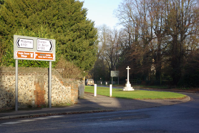
Image: © Stephen McKay Taken: 6 Dec 2009
At this point the A1101 Bury St Edmunds - Mildenhall road meets a B road running from Westley - Great Barton. The number of the B road seems to be a matter of confusion; maps - including the Ordnance Survey - show it as the B1106 (which is also the Bury St Edmunds - Brandon road) but Suffolk County Council and its road signs have it as the B1066 (which is also the Long Melford - Horringer road). There is a war memorial on the corner.
Images are licensed for reuse under creativecommons.org/licenses/by-sa/2.0
Image Location
Latitude
52.273902
Longitude
0.689909