
IMAGES TAKEN NEAR TO
Weeting, BRANDON, IP27 0RB
Introduction
This page details the photographs taken nearby to IP27 0RB by members of the Geograph project.
The Geograph project started in 2005 with the aim of publishing, organising and preserving representative images for every square kilometre of Great Britain, Ireland and the Isle of Man.

There are currently over 7.5m images from over14,400 individuals and you can help contribute to the project by visiting https://www.geograph.org.uk
Image Map
Images are licensed for reuse under creativecommons.org/licenses/by-sa/2.0
Notes
- Clicking on the map will re-center to the selected point.
- The higher the marker number, the further away the image location is from the centre of the postcode.
Image Listing (9 Images Found)
Images are licensed for reuse under creativecommons.org/licenses/by-sa/2.0
Image
Details
Distance
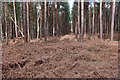
3
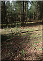
Saplings planted within a plantation
There is a move to diversify the species planted in Thetford Forest, but many of new species need the protection of existing trees to get established. See Image
Image: © Hugh Venables
Taken: 1 Mar 2020
0.16 miles
5
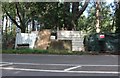
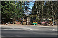
Modern art by Mundford Road
It's not actually art, the property owner has lined the road with this along the edge of their land and has been there for some years enriching the scenery. They may be the victim of the sort of thing they made the hoarding programmes about.
Image: © David Howard
Taken: 19 Jul 2020
0.20 miles
7

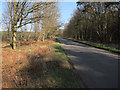
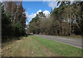
Mundford Road near Weeting
Emily's Wood has just become Snake Wood heading north.
Image: © David Howard
Taken: 19 Jul 2020
0.22 miles
8
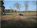
Restricted byway joining A1065
With a field beyond enclosed by Thetford Forest.
Image: © Hugh Venables
Taken: 11 Mar 2012
0.22 miles
9
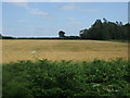
Crop field, The Brecks
East of the A1065, a clearing between woodland.
Image: © JThomas
Taken: 16 Jul 2015
0.23 miles