IMAGES TAKEN NEAR TO
Nursery Lane, THETFORD, IP26 4ND
Introduction
This page details the photographs taken nearby to Nursery Lane, IP26 4ND by members of the Geograph project.
The Geograph project started in 2005 with the aim of publishing, organising and preserving representative images for every square kilometre of Great Britain, Ireland and the Isle of Man.

There are currently over 7.5m images from over14,400 individuals and you can help contribute to the project by visiting https://www.geograph.org.uk
Image Map
Images are licensed for reuse under creativecommons.org/licenses/by-sa/2.0
Notes
- Clicking on the map will re-center to the selected point.
- The higher the marker number, the further away the image location is from the centre of the postcode.
Image Listing (83 Images Found)
Images are licensed for reuse under creativecommons.org/licenses/by-sa/2.0
Image
Details
Distance
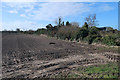
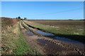
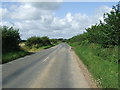
2
Nursery Lane
Nursery Lane Hockwold Cum Wilton, Norfolk.
Image: © Keith Evans
Taken: 19 Apr 2016
0.09 miles
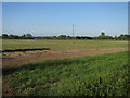
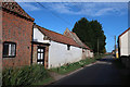
7
Wilton Farm
On the edge of Hockwold cum Wilton.
Image: © Hugh Venables
Taken: 23 Jun 2012
0.16 miles
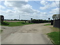
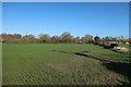
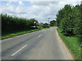
8
Hockwold Road
Hockwold Road looking west towards Hockwold, Norfolk.
Image: © Keith Evans
Taken: 2 Aug 2012
0.17 miles
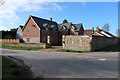
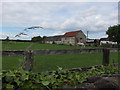
9
Entering Hockwold
Village name sign as you enter Hockwolk, Norfolk.
Image: © Keith Evans
Taken: 2 Aug 2012
0.18 miles