IMAGES TAKEN NEAR TO
Mill Lane, THETFORD, IP26 4LR

Introduction

This page details the photographs taken nearby to Mill Lane, IP26 4LR by members of the Geograph project.

The Geograph project started in 2005 with the aim of publishing, organising and preserving representative images for every square kilometre of Great Britain, Ireland and the Isle of Man.

There are currently over 7.5m images from over14,400 individuals and you can help contribute to the project by visiting https://www.geograph.org.uk

Image Map


Images are licensed for reuse under creativecommons.org/licenses/by-sa/2.0
Notes
  • Clicking on the map will re-center to the selected point.
  • The higher the marker number, the further away the image location is from the centre of the postcode.

Image Listing (7 Images Found)

Images are licensed for reuse under creativecommons.org/licenses/by-sa/2.0
Image
Details
Distance
1
The Red Lion in Wilton cum Hockwold, Norfolk
The Red Lion public house is in the centre of the village of Wilton just a stone's throw away from the church of St James. > http://www.geograph.org.uk/photo/2000006
Image: © Adrian S Pye Taken: 5 Aug 2010
0.18 miles
2
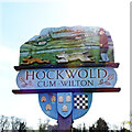
Hockwold village sign
Hockwold cum Wilton's sign is located at the bowls green. It depicts the two churches, on the left, the church of Wilton St James and its rare 14th century spire. On the right is the now redundant church of St Peter, Hockwold. The stream depicts the Little Ouse, which is the southern boundary of the parishes and the county. In the foreground are a hare, two dogs and their handler, recalling the activities of the widely known Hockwold Coursing Club (1920-1939). Below the name, are three devices. Three bee skeps relate to the 17 mentioned in the Domesday Book. The wool sacks recall the days of the 15th and 16th century wool industry. Finally, the chequerboard pattern symbolises the blue and gold arms of Earl William de Warenne who held much land in the area after Domesday. The previous sign also bore six loaves of bread and acorns. The loaves represented an early charity when six loaves were provided weekly for six poor Protestants, and the acorns represented the 'pannage for 200 hogs and 30 goats'. https://www.geograph.org.uk/photo/6793536
Image: © Adrian S Pye Taken: 29 Mar 2021
0.18 miles
3
Hockwold cum Wilton village sign
Hockwold cum Wilton's sign is located at the bowls green. It depicts the two churches, on the left, the church of Wilton St James and its rare 14th century spire. On the right is the now redundant church of St Peter, Hockwold. The stream depicts the Little Ouse, which is the southern boundary of the parishes and the county. In the foreground are a hare, two dogs and their handler, recalling the activities of the widely known Hockwold Coursing Club (1920-1939). Below the name, are three devices. Three bee skeps relate to the 17 mentioned in the Domesday Book. The wool sacks recall the days of the 15th and 16th century wool industry. Finally, the chequerboard pattern symbolises the blue and gold arms of Earl William de Warenne who held much land in the area after Domesday. The previous sign also bore six loaves of bread and acorns. The loaves represented an early charity when six loaves were provided weekly for six poor Protestants, and the acorns represented the 'pannage for 200 hogs and 30 goats'. https://www.geograph.org.uk/photo/6793533
Image: © Adrian S Pye Taken: 29 Mar 2021
0.18 miles
4
Houses on Main Street, Hockwold cum Wilton
Image: © JThomas Taken: 19 Aug 2017
0.18 miles
5
Hockwold Store and Post Office
On Main Street.
Image: © JThomas Taken: 19 Aug 2017
0.19 miles
6
Hockwold Village Hall
Image: © JThomas Taken: 19 Aug 2017
0.20 miles
7
Hockwold Methodist Church 1875
Image: © Adrian S Pye Taken: 5 Aug 2010
0.23 miles