
IMAGES TAKEN NEAR TO
Southery Road, THETFORD, IP26 4EH
Introduction
This page details the photographs taken nearby to Southery Road, IP26 4EH by members of the Geograph project.
The Geograph project started in 2005 with the aim of publishing, organising and preserving representative images for every square kilometre of Great Britain, Ireland and the Isle of Man.

There are currently over 7.5m images from over14,400 individuals and you can help contribute to the project by visiting https://www.geograph.org.uk
Image Map
Images are licensed for reuse under creativecommons.org/licenses/by-sa/2.0
Notes
- Clicking on the map will re-center to the selected point.
- The higher the marker number, the further away the image location is from the centre of the postcode.
Image Listing (9 Images Found)
Images are licensed for reuse under creativecommons.org/licenses/by-sa/2.0
Image
Details
Distance
1
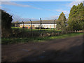
Bird Brand factory
R K & J Jones Limited, which trades as Bird Brand, is a family business manufacturing and distributing a range of building and decorating products such as paints and solvents.
Image: © Hugh Venables
Taken: 7 Jan 2012
0.01 miles
2
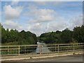
Bridge over Cut Off Channel
Worryingly the bridge appears to have some missing railings...
Image: © Alison Rawson
Taken: 29 Sep 2007
0.11 miles
3
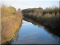
Cut-off Channel
From Southery Road near Feltwell. The Cut-off Channel is a major drain along the eastern side of the Fens from Image at the River Lark to Image
Image: © Hugh Venables
Taken: 7 Jan 2012
0.11 miles
4
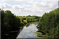
Cut-off Channel from Southery Road bridge
Looking northwards from the bridge across the drainage channel.
Image: © Bob Jones
Taken: 11 Aug 2009
0.11 miles
5
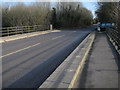
Southery Road bridge
Over the Cut-off Channel to Feltwell.
Image: © Hugh Venables
Taken: 7 Jan 2012
0.13 miles
6
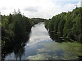
Cut Off Channel
Looking upstream from the bridge at Feltwell.
Image: © Alison Rawson
Taken: 29 Sep 2007
0.17 miles
7
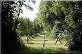
Environment Agency gateway
This gate and track lead southwards from the minor road between Feltwell and Southery, providing access to the western side of the Cut-off Channel.
Image: © Bob Jones
Taken: 11 Aug 2009
0.19 miles
8
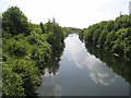
Cut-off Channel near Feltwell
A major drain on the eastern edge of the Fens. Seen from the bridge on the Southery to Feltwell road.
Image: © Oliver Dixon
Taken: 8 Jun 2007
0.22 miles
9
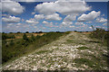
Bank of the Cut-off Channel
The Cut-off Channel, a wide drainage ditch skirting the eastern edge of the Fens, takes flood waters from three rivers and was completed in 1964. A mammoth undertaking, the top of the banks at this point near Feltwell are some 15 metres above the normal water level (which can just be seen to the left of the photo). The banks were created mainly from chalk, which creates a different local eco-system from the surrounding low-lying land.
Image: © Bob Jones
Taken: 11 Aug 2009
0.23 miles