IMAGES TAKEN NEAR TO
Hall Farm Close, THETFORD, IP26 4DS
Introduction
This page details the photographs taken nearby to Hall Farm Close, IP26 4DS by members of the Geograph project.
The Geograph project started in 2005 with the aim of publishing, organising and preserving representative images for every square kilometre of Great Britain, Ireland and the Isle of Man.

There are currently over 7.5m images from over14,400 individuals and you can help contribute to the project by visiting https://www.geograph.org.uk
Image Map
Images are licensed for reuse under creativecommons.org/licenses/by-sa/2.0
Notes
- Clicking on the map will re-center to the selected point.
- The higher the marker number, the further away the image location is from the centre of the postcode.
Image Listing (123 Images Found)
Images are licensed for reuse under creativecommons.org/licenses/by-sa/2.0
Image
Details
Distance
1
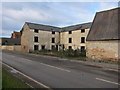
Bell Street, Feltwell
Empty building just east of the Church.
Image: © Hugh Venables
Taken: 7 Jan 2012
0.05 miles
3
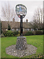
Village sign, Feltwell
In front of some almshouses.
Image: © Hugh Venables
Taken: 7 Jan 2012
0.05 miles
4
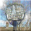
Feltwell village sign
The name Feltwell is derived from the Saxon meaning "the settlement in the meadow by the stream“. In the background is the church of St Nicholas as it was before the tower collapsed. Sheep graze in the meadow by the stream. The tree depicted was estimated to be 1300 years old when felled on 23rd April, 1964. The girth measured over 32 feet. (My great Uncle lived in the village and I remember climbing it when I was 9 or 10 years old.) The lady with the hunting dogs is Alveva, a Saxon lady who owned part of Feltwell and Hockwold at the time of the Norman Conquest. Her daughter, Aldgyta, married Harold, son of Godwin, who became King. On the spandrels are two coats of arms, Moundeford and Clough. The truncated shepherd's crook carved on the face of the supporting post is in tribute to Edward Atmere, a shepherd, who in 1579, gave £60 for the purchase of land, the rent from which was to be paid to the churchwardens of Foulden, Northwold, Feltwell, Weeting and Brandon for the use of the poor. Thanks to A. J. Orange who designed the sign. https://www.geograph.org.uk/photo/6790714
Image: © Adrian S Pye
Taken: 29 Mar 2021
0.05 miles
5
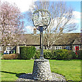
Feltwell village sign and almshouses
The name Feltwell is derived from the Saxon meaning "the settlement in the meadow by the stream“. In the background is the church of St Nicholas as it was before the tower collapsed. Sheep graze in the meadow by the stream. The tree depicted was estimated to be 1300 years old when felled on 23rd April, 1964. The girth measured over 32 feet. (My great Uncle lived in the village and I remember climbing it when I was 9 or 10 years old.) The lady with the hunting dogs is Alveva, a Saxon lady who owned part of Feltwell and Hockwold at the time of the Norman Conquest. Her daughter, Aldgyta, married Harold, son of Godwin, who became King. On the spandrels are the sign are two coats of arms, Moundeford and Clough. The truncated shepherd's crook carved on the face of the supporting post is in tribute to Edward Atmere, a shepherd, who in 1579, gave £60 for the purchase of land, the rent from which was to be paid to the churchwardens of Foulden, Northwold, Feltwell, Weeting and Brandon for the use of the poor. Thanks to A. J. Orange who designed the sign. https://www.geograph.org.uk/photo/6790712
Image: © Adrian S Pye
Taken: 29 Mar 2021
0.05 miles
6
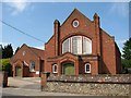
Methodist church in Beck Street, Feltwell
Image: © Evelyn Simak
Taken: 25 May 2010
0.06 miles
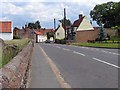
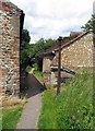
9
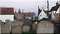
East along Bell Street from St Mary's churchyard, Feltwell
Image: © Chris Brown
Taken: 5 Nov 2017
0.08 miles