
IMAGES TAKEN NEAR TO
Banham Walk, THETFORD, IP26 4AG
Introduction
This page details the photographs taken nearby to Banham Walk, IP26 4AG by members of the Geograph project.
The Geograph project started in 2005 with the aim of publishing, organising and preserving representative images for every square kilometre of Great Britain, Ireland and the Isle of Man.

There are currently over 7.5m images from over14,400 individuals and you can help contribute to the project by visiting https://www.geograph.org.uk
Image Map
Images are licensed for reuse under creativecommons.org/licenses/by-sa/2.0
Notes
- Clicking on the map will re-center to the selected point.
- The higher the marker number, the further away the image location is from the centre of the postcode.
Image Listing (5 Images Found)
Images are licensed for reuse under creativecommons.org/licenses/by-sa/2.0
Image
Details
Distance
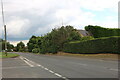
2
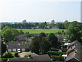
Looking South from St Mary's tower
From the top of the tower the village playing field can be seen behind a small estate of bungalows. The three large radomes of the USAF Deep Space Tracking station on RAF Feltwell dominate the horizon. For more photographs of Feltwell go to http://www.feltwell.org
Image: © Paul Garland
Taken: 9 Jun 2007
0.15 miles
3
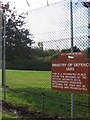
Kept out
This fence and dense vegetation prevents the passer-by from seeing anything.
Image: © Alison Rawson
Taken: 29 Sep 2007
0.20 miles
5
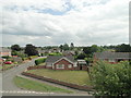
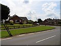
Looking south from the clock room at Feltwell St Mary's church
From the window in the clock room at Feltwell church looking up Hall Drive.
Image: © Adrian S Pye
Taken: 5 Aug 2010
0.25 miles