IMAGES TAKEN NEAR TO
Euston Road, THETFORD, IP24 2SJ

Introduction

This page details the photographs taken nearby to Euston Road, IP24 2SJ by members of the Geograph project.

The Geograph project started in 2005 with the aim of publishing, organising and preserving representative images for every square kilometre of Great Britain, Ireland and the Isle of Man.

There are currently over 7.5m images from over14,400 individuals and you can help contribute to the project by visiting https://www.geograph.org.uk

Image Map


Images are licensed for reuse under creativecommons.org/licenses/by-sa/2.0
Notes
  • Clicking on the map will re-center to the selected point.
  • The higher the marker number, the further away the image location is from the centre of the postcode.

Image Listing (110 Images Found)

Images are licensed for reuse under creativecommons.org/licenses/by-sa/2.0
  • ...
Image
Details
Distance
1
Flint and brick cottages in Rushford village
Image: © Evelyn Simak Taken: 15 Apr 2015
0.02 miles
2
Speed restriction signs on entering Rushford
Image: © Adrian S Pye Taken: 15 Apr 2015
0.02 miles
3
Crop field beside Rushford Road
Image: © Evelyn Simak Taken: 15 Apr 2015
0.03 miles
4
Little Ouse River by Rushford
Due to recent heavy rainfalls the water in the river is high and murky and many of the adjoining pastures are flooded. The name Rushford comes from the original crossing point, a ford on the Little Ouse River, which here forms the boundary between Norfolk and Suffolk.
Image: © Evelyn Simak Taken: 1 Mar 2010
0.06 miles
5
Rushford Road at the junction of Spalding's Chair Hill
Image: © David Howard Taken: 18 Apr 2021
0.06 miles
6
Rushford Bridge viewed from the south-west
The Grade II listed Rushford bridge takes the road over the Little Ouse River and across the Norfolk / Suffolk border. Due to recent heavy rainfalls the water in the river is high and murky and many of the adjoining pastures are flooded. The name Rushford comes from the original crossing point, a ford on the Little Ouse River, which here forms the boundary between Norfolk and Suffolk.
Image: © Evelyn Simak Taken: 1 Mar 2010
0.06 miles
7
Rushford: Shoulder of Mutton Plantation
Image: © Michael Garlick Taken: 5 Sep 2020
0.06 miles
8
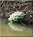
Snowdrops by Rushford Bridge
For a wider view of this location see > http://www.geograph.org.uk/photo/1731640. Snowdrops (Galanthus nivalis) can be found from January until March and are a good indicator that winter is coming to an end. Fairly widespread nowadays, snowdrops were once quite rare in Britain, and were found only in damp woodlands.
Image: © Evelyn Simak Taken: 1 Mar 2010
0.07 miles
9
Woodlands by Rushford Road
The ubiquitous Norfolk conifers
Image: © David Howard Taken: 18 Apr 2021
0.07 miles
10
C635 Rushford Road, Rushford
At the junction with the C147 Rushford Road & C640 Spalding's Chair Hill
Image: © Geographer Taken: 18 Jun 2016
0.07 miles
  • ...