1
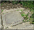
Concreted WW2 road
Entrance into the aerodrome's Mess site.
Image: © Evelyn Simak
Taken: 3 Jun 2015
0.01 miles
2
Workshop at Mayfair Engineering
The business is located on the Mess site of RAF Eye, which was an active airfield during WW2.
Image: © Evelyn Simak
Taken: 3 Jun 2015
0.03 miles
3
Disused sheds at the old mink farm
Image: © Evelyn Simak
Taken: 3 Jun 2015
0.04 miles
4
View towards Little Garth
This is the view from the WAAF site towards the airfield's Mess site at what is currently marked on the map as Mink Farm, across the field from here.
Image: © Evelyn Simak
Taken: 3 Jun 2015
0.07 miles
5
Old concreted track
This is one of the old concreted roads constructed during WW2, which linked the dispersed camp sites of RAF Eye with each other. The former Mess site was located at the now overgrown area seen at left.
Image: © Evelyn Simak
Taken: 6 Jun 2015
0.08 miles
6
Concreted track by Mink Farm
This used to be the location of the former Mess site of RAF Eye, which was an active airfield during WW2.
Image: © Evelyn Simak
Taken: 6 Jun 2015
0.09 miles
7
To Church Farm on Nick's Lane
Nick's Lane was the main road linking the airfield's various sites with each other. The track also links the B1077 road running past the former Technical site, now occupied by industrial estates, with Rectory Road in the east.
Image: © Evelyn Simak
Taken: 3 Jun 2015
0.10 miles
8
Manhole cover
For a wider view of this location see > http://www.geograph.org.uk/photo/4512561.
Image: © Evelyn Simak
Taken: 6 Jun 2015
0.11 miles
9
Fields south of Little Garth
The track is one of the old concreted roads constructed during WW2, which linked the dispersed camp sites of RAF Eye with each other. This section leads past the former Mess site.
Image: © Evelyn Simak
Taken: 6 Jun 2015
0.12 miles
10
Entrance into the Communal site
During WW2, this used to be the location of the Communal site of RAF Eye.
Image: © Evelyn Simak
Taken: 4 Jun 2015
0.15 miles


