
IMAGES TAKEN NEAR TO
Mill Road, DISS, IP22 5TW
Introduction
This page details the photographs taken nearby to Mill Road, IP22 5TW by members of the Geograph project.
The Geograph project started in 2005 with the aim of publishing, organising and preserving representative images for every square kilometre of Great Britain, Ireland and the Isle of Man.

There are currently over 7.5m images from over14,400 individuals and you can help contribute to the project by visiting https://www.geograph.org.uk
Image Map
Images are licensed for reuse under creativecommons.org/licenses/by-sa/2.0
Notes
- Clicking on the map will re-center to the selected point.
- The higher the marker number, the further away the image location is from the centre of the postcode.
Image Listing (109 Images Found)
Images are licensed for reuse under creativecommons.org/licenses/by-sa/2.0
Image
Details
Distance
2
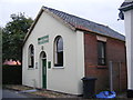
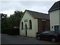
Burston Chapel
Off Mill Road
http://www.burstonchapel.co.uk/
Image: © Geographer
Taken: 11 Sep 2013
0.01 miles
3
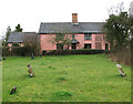
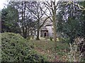
Cottage adjoining St Mary's churchyard
For a view of the church see > http://www.geograph.org.uk/photo/1773271.
Image: © Evelyn Simak
Taken: 27 Mar 2010
0.03 miles
4
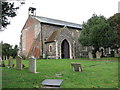
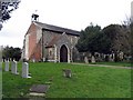
The church of St Mary in Burston
St Mary's church > http://www.geograph.org.uk/photo/1773271 - it lost its tower in the 18th century - in the village of Burston adjoins the village green and the Burston Strike School > http://www.geograph.org.uk/photo/1773265. When the teachers Mr and Mrs Higdon in 1914 clashed with the parson and the county education committee they were evicted from the school house and opened a rival school in 1917, with local support and the national trades union backing. The Strike School closed in 1939 and now houses a museum. Services are still being held in St Mary's church. However, the nave > http://www.geograph.org.uk/photo/1773301 has been cleared of pews, functioning as a community room where concerts, art exhibitions, coffee mornings and other fund-raising events are being held. The chancel is separated from the nave by a wrought-iron screen > http://www.geograph.org.uk/photo/1773305 with a door in it. The pulpit > http://www.geograph.org.uk/photo/1773323 remains in its place as do the 14th century font > http://www.geograph.org.uk/photo/1773331 and a fine set of royal arms > http://www.geograph.org.uk/photo/1773334 for James I still hangs on the west wall.
Image: © Evelyn Simak
Taken: 27 Mar 2010
0.04 miles
5
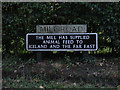
Mill Road sign
On Mill Road at the junction with Crown Green, Rectory & Diss Roads near The Burston Crown Public House
Image: © Geographer
Taken: 11 Sep 2013
0.04 miles
8
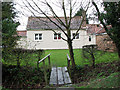
The Strike School
The bridge seen in the foreground leads a path from St Mary's > http://www.geograph.org.uk/photo/1773271 churchyard to the Strike School and to the village green beyond. When the teachers Mr and Mrs Higdon in 1914 clashed with the parson and the county education committee they were evicted from the school house and opened a rival school in 1917, with local support and the national trades union backing. The Strike School closed in 1939 and now houses a museum.
Image: © Evelyn Simak
Taken: 27 Mar 2010
0.04 miles
9
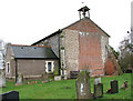
The church of St Mary in Burston
St Mary's church > http://www.geograph.org.uk/photo/1773271 - it lost its tower in the 18th century - in the village of Burston adjoins the village green and the Burston Strike School > http://www.geograph.org.uk/photo/1773265. When the teachers Mr and Mrs Higdon in 1914 clashed with the parson and the county education committee they were evicted from the school house and opened a rival school in 1917, with local support and the national trades union backing. The Strike School closed in 1939 and now houses a museum. Services are still being held in St Mary's church. However, the nave > http://www.geograph.org.uk/photo/1773301 has been cleared of pews, functioning as a community room where concerts, art exhibitions, coffee mornings and other fund-raising events are being held. The chancel is separated from the nave by a wrought-iron screen > http://www.geograph.org.uk/photo/1773305 with a door in it. The pulpit > http://www.geograph.org.uk/photo/1773323 remains in its place as do the 14th century font > http://www.geograph.org.uk/photo/1773331 and a fine set of royal arms > http://www.geograph.org.uk/photo/1773334 for James I still hangs on the west wall.
Image: © Evelyn Simak
Taken: 27 Mar 2010
0.04 miles
10
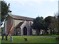
Burston St. Mary's church
Burston church lost its tower in 1753 when it collapsed and it was never rebuilt. A small bellcote was erected to house a single bell. Really there is little of interest here but what there is, I suppose is worth a visit The church dates from the 14th c. and the interesting plain octagonal font is coeval with the church. Around the base are the figures of eight saints. For some reason the chancel is barred to visitors by a large pair of iron gates which are well padlocked. Above the south porch are the wonderfully preserved Royal Arms of James I. The nave has been stripped of all the benches and individual chairs and tables scattered throughout. I fear that the church is turning into a village hall and although it is a sign of the times it, and the offensive iron gates, somehow de-sanctifies of the church.
Image: © Adrian S Pye
Taken: 6 Apr 2007
0.04 miles