The church of St Mary in Burston
Introduction
The photograph on this page of The church of St Mary in Burston by Evelyn Simak as part of the Geograph project.
The Geograph project started in 2005 with the aim of publishing, organising and preserving representative images for every square kilometre of Great Britain, Ireland and the Isle of Man.

There are currently over 7.5m images from over 14,400 individuals and you can help contribute to the project by visiting https://www.geograph.org.uk
The church of St Mary in Burston
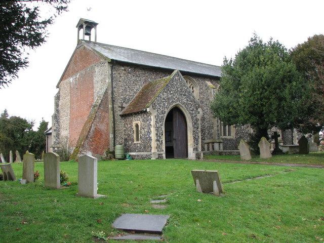
Image: © Evelyn Simak Taken: 27 Mar 2010
St Mary's church > http://www.geograph.org.uk/photo/1773271 - it lost its tower in the 18th century - in the village of Burston adjoins the village green and the Burston Strike School > http://www.geograph.org.uk/photo/1773265. When the teachers Mr and Mrs Higdon in 1914 clashed with the parson and the county education committee they were evicted from the school house and opened a rival school in 1917, with local support and the national trades union backing. The Strike School closed in 1939 and now houses a museum. Services are still being held in St Mary's church. However, the nave > http://www.geograph.org.uk/photo/1773301 has been cleared of pews, functioning as a community room where concerts, art exhibitions, coffee mornings and other fund-raising events are being held. The chancel is separated from the nave by a wrought-iron screen > http://www.geograph.org.uk/photo/1773305 with a door in it. The pulpit > http://www.geograph.org.uk/photo/1773323 remains in its place as do the 14th century font > http://www.geograph.org.uk/photo/1773331 and a fine set of royal arms > http://www.geograph.org.uk/photo/1773334 for James I still hangs on the west wall.
Images are licensed for reuse under creativecommons.org/licenses/by-sa/2.0
Image Location
Latitude
52.405056
Longitude
1.14018