1
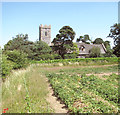
All Saints Church House, Knettishall
Off the C146 The Street
Image: © Geographer
Taken: 2 Jul 2016
0.00 miles
2
View towards All Saints church
This church has been converted into a private dwelling, dormer windows and all.
Image: © Evelyn Simak
Taken: 15 Apr 2015
0.01 miles
3
The former church of All Saints, Knettishall
Still marked on the map as derelict, the building has since been restored and converted into a private dwelling.
Image: © Evelyn Simak
Taken: 10 Jul 2015
0.01 miles
4
Minor road past All Saints church
The church is still marked on the map as derelict but has since been restored and converted into a private dwelling. Ammunition storage huts were aligned along the road here during WW2, when RAF Knettishall was an active airfield.
Image: © Evelyn Simak
Taken: 10 Jul 2015
0.01 miles
5
The tower of Knettishall church
This used to be All Saints, the parish church of Knettishall. During the early part of the 20th century it fell into disuse and dereliction and has since been converted into a private dwelling.
Image: © Robert Edwards
Taken: 27 Jun 2012
0.01 miles
6
All Saints Church Knettishall
The church is a semi-ruin.
Image: © Bikeboy
Taken: 10 Apr 2013
0.01 miles
7
All Saints Church, Knettishall
The church deteriorated as it was marooned within the grounds of the former Knettishall airfield. The nave section has now been converted into a private dwelling.
Image: © Andrew Hill
Taken: 13 May 2008
0.01 miles
8
C146 The Street, Knettishall
At the entrance of All Saints Church House
Image: © Geographer
Taken: 2 Jul 2016
0.02 miles
9
C146 The Street, Knettishall
Approaching the junction with the C636 Nethergate Street near All Saints Church House
Image: © Geographer
Taken: 2 Jul 2016
0.03 miles
10
C146 The Street, Knettishall
Near All Saints Church House
Image: © Geographer
Taken: 2 Jul 2016
0.03 miles


