
IMAGES TAKEN NEAR TO
School Lane, DISS, IP22 1LD
Introduction
This page details the photographs taken nearby to School Lane, IP22 1LD by members of the Geograph project.
The Geograph project started in 2005 with the aim of publishing, organising and preserving representative images for every square kilometre of Great Britain, Ireland and the Isle of Man.

There are currently over 7.5m images from over14,400 individuals and you can help contribute to the project by visiting https://www.geograph.org.uk
Image Map
Images are licensed for reuse under creativecommons.org/licenses/by-sa/2.0
Notes
- Clicking on the map will re-center to the selected point.
- The higher the marker number, the further away the image location is from the centre of the postcode.
Image Listing (91 Images Found)
Images are licensed for reuse under creativecommons.org/licenses/by-sa/2.0
Image
Details
Distance
2
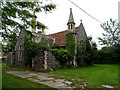
Village hall, Thelnetham
It appears to be derelict. Formerly the village school, opened in 1872.
Image: © Bikeboy
Taken: 29 May 2014
0.02 miles
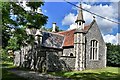
4
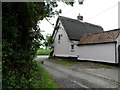
Eighteenth century cottage, Thelnetham
See http://www.britishlistedbuildings.co.uk/en-284341-the-cottage-thelnetham-suffolk for further information.
Image: © Bikeboy
Taken: 29 May 2014
0.04 miles
5

Thelnetham village sign
The sign itself consists of a pair of railings also seen in https://www.geograph.org.uk/photo/6640600 which were made by George T. Bloomfield who had a foundry in Thelnetham High Street in 1851. They once formed part of the culvert at Cross Green and are the only known example of the parishes industrial past. When they were dismantled in 1982 someone had the foresight to save them from the smelter.
https://www.geograph.org.uk/photo/6640600
Image: © Adrian S Pye
Taken: 16 Oct 2020
0.05 miles
6

Thelnetham village sign
A simple announcement that this is Thelnetham with a notice board of forthcoming and past events. https://www.geograph.org.uk/photo/6640623
The bell turret seen on the other side of the hedge is the village hall, formerly the St. Helen's Church of England School, built in 1872 and grade II listed. https://www.geograph.org.uk/photo/6512273
Image: © Adrian S Pye
Taken: 16 Oct 2020
0.05 miles
7
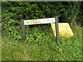
School Lane sign
On School Lane at the junction with the C637 Hopton Road, C637 Church Lane & High Street
Image: © Geographer
Taken: 5 Jul 2016
0.05 miles
8
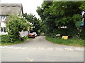
School Lane, Thelnetham
At the junction with the C637 Hopton Road, C637 Church Lane & High Street
Image: © Geographer
Taken: 5 Jul 2016
0.05 miles
9
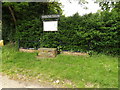
Thelnetham Village sign & Notice Board
On the C637 Church Lane at the junction with the C637 Hopton Road, High Street & School Lane
Image: © Geographer
Taken: 5 Jul 2016
0.05 miles
10
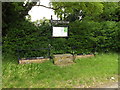
Thelnetham Village sign & Notice Board
On the C637 Church Lane at the junction with the C637 Hopton Road, High Street & School Lane
Image: © Geographer
Taken: 5 Jul 2016
0.05 miles