
IMAGES TAKEN NEAR TO
Station Road, DISS, IP21 4TE
Introduction
This page details the photographs taken nearby to Station Road, IP21 4TE by members of the Geograph project.
The Geograph project started in 2005 with the aim of publishing, organising and preserving representative images for every square kilometre of Great Britain, Ireland and the Isle of Man.

There are currently over 7.5m images from over14,400 individuals and you can help contribute to the project by visiting https://www.geograph.org.uk
Image Map
Images are licensed for reuse under creativecommons.org/licenses/by-sa/2.0
Notes
- Clicking on the map will re-center to the selected point.
- The higher the marker number, the further away the image location is from the centre of the postcode.
Image Listing (69 Images Found)
Images are licensed for reuse under creativecommons.org/licenses/by-sa/2.0
Image
Details
Distance
1
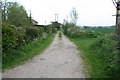
Disused railway line
Directly opposite the old railway station.
Image: © Duncan Grey
Taken: 3 May 2008
0.06 miles
2
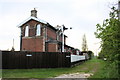
The Old Railway Station
Now a private house,
Image: © Duncan Grey
Taken: 3 May 2008
0.06 miles
4
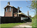
Former railway station at Pulham Market
Image: © Adrian S Pye
Taken: 16 Apr 2015
0.11 miles
5
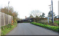
The former railway crossing at Pulham Market
The crossing was designated the number 13 and was down from the railway station.
As with most crossings the road is raised at the crossing point because of the track being embanked. The signal Box stood just to the right of the crossing on this, the Up-side of the line.
Image: © Adrian S Pye
Taken: 9 Dec 2022
0.13 miles
6
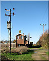
Transformer by Pulham Market Station
This view was taken looking north-west along the dismantled trackbed of the Waveney Valley Line. The former station building can be seen in mid distance.
The Waveney Valley Line ran from a junction with the London to Norwich mainline at Tivetshall > http://www.geograph.org.uk/photo/1572341 - http://www.geograph.org.uk/photo/1572337, servicing the market towns of Harleston, Bungay and Beccles, where it connected with the East Suffolk line to Yarmouth. The line was opened between 1855 and 1863 but its first stations (Starston > http://www.geograph.org.uk/photo/1592857 and Redenhall) were closed as early as 1866. The passenger service was eventually withdrawn in 1953. Freight services were but back in 1960 and in 1966 the line was closed. Part of its route - between Harleston and Broome - has since been taken over by the realigned A143 road.
Image: © Evelyn Simak
Taken: 25 Nov 2009
0.13 miles
7
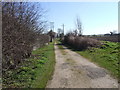
Dismantled Railway Line, Pulham Market
Image: © Ian Robertson
Taken: 12 Mar 2007
0.13 miles
8
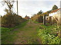
Approaching Pulham Market Station
On the former trackbed passing Bridge Farm, with the crossing gates ahead and the station building in sight.
On the immediate left is where the Admiralty Siding loop turnout was located. The siding was constructed in 1915-16 to serve Pulham Airfield and the experimentation and operation of the airships. The Royal Naval Air Station was established in 1912, on land acquired from 3 farms, including Upper Vaunces farm, and the siding officially named Upper Vaunces Farm Siding. Airships flew from here to engage in patrols over the North Sea.
Image: © Adrian S Pye
Taken: 2 Dec 2022
0.13 miles
9
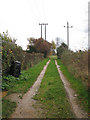
The Waveney Valley Line - the former trackbed
View south-east along the dismantled trackbed of the Waveney Valley Line as it passes Pulham Market Station > http://www.geograph.org.uk/photo/1592892. This is now a private farm track. The converted station building is immediately north-west from here.
The Waveney Valley Line ran from a junction with the London to Norwich mainline at Tivetshall > http://www.geograph.org.uk/photo/1572341 - http://www.geograph.org.uk/photo/1572337, servicing the market towns of Harleston,, Bungay and Beccles, where it connected with the East Suffolk line to Yarmouth. The line was opened between 1855 and 1863 but its first stations (Starston > http://www.geograph.org.uk/photo/1592857 and Redenhall) were closed as early as 1866. The passenger service was eventually withdrawn in 1953. Freight services were but back in 1960 and in 1966 the line was closed. Part of its route - between Harleston and Broome - has since been taken over by the realigned A143 road.
Image: © Evelyn Simak
Taken: 23 Nov 2009
0.13 miles
10
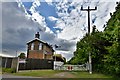
Pulham Market: The Old Railway Station
Image: © Michael Garlick
Taken: 1 May 2020
0.13 miles