IMAGES TAKEN NEAR TO
Dickleburgh Road, DISS, IP21 4RX
Introduction
This page details the photographs taken nearby to Dickleburgh Road, IP21 4RX by members of the Geograph project.
The Geograph project started in 2005 with the aim of publishing, organising and preserving representative images for every square kilometre of Great Britain, Ireland and the Isle of Man.

There are currently over 7.5m images from over14,400 individuals and you can help contribute to the project by visiting https://www.geograph.org.uk
Image Map
Images are licensed for reuse under creativecommons.org/licenses/by-sa/2.0
Notes
- Clicking on the map will re-center to the selected point.
- The higher the marker number, the further away the image location is from the centre of the postcode.
Image Listing (107 Images Found)
Images are licensed for reuse under creativecommons.org/licenses/by-sa/2.0
Image
Details
Distance
2
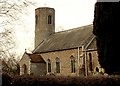
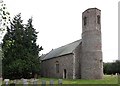
St. Mary's church at Rushall, Norfolk
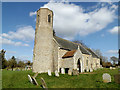
This is one of the many Norfolk churches with a Norman round tower and this one, like others too, has an octagonal upper stage. It looks like re-used Roman brick has been used in the tower's construction. The rest of the church was built during the 13th and 14th centuries.
Image: © Robert Edwards
Taken: 1 Mar 2007
0.05 miles
3
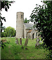
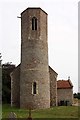
St Mary's church
This is the view of St Mary's church from the public footpath which traverses the churchyard. The path leads from here to Norton's Farm, further to the south-west.
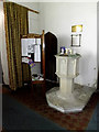
St Mary's church > http://www.geograph.org.uk/photo/1366136 - http://www.geograph.org.uk/photo/1366177 - http://www.geograph.org.uk/photo/1366208 has a round tower which has not been dated exactly because it has characteristics of both Saxon and Norman architecture - most authorities take it to date from Norman times. The octagonal top was added in the 15th century. The south porch was built in the 15th century. The nave, which houses a C15 octagonal font > http://www.geograph.org.uk/photo/1366216 is thought to be older. The chancel > http://www.geograph.org.uk/photo/1366184 was built in the 13th century and has a Stuart communion table. The church was extensively restored in the late 1800s. St Mary's is open every day.
Image: © Evelyn Simak
Taken: 22 Jun 2009
0.05 miles
4
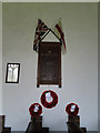
The War Memorial in Rushall church
The memorial has 9 names for WW1, they are: Arthur Gerald Allum, George Frederick Chappell,Thomas Frank Collings,Benjamin Snowling Grimble, Edward Linder, Charlie Burrows Peake,Frank William Robert Pymar, Percy Charles Reeve, Leonard George Saunders. The names for WW2 are: Henry Noel Munro & John Arthur Collum.
Image: © Adrian S Pye
Taken: 16 Apr 2015
0.05 miles
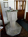
7
St.Mary's Church, Rushall
Off Langmere Road
Image: © Geographer
Taken: 10 Mar 2015
0.05 miles