St Mary's church
Introduction
The photograph on this page of St Mary's church by Evelyn Simak as part of the Geograph project.
The Geograph project started in 2005 with the aim of publishing, organising and preserving representative images for every square kilometre of Great Britain, Ireland and the Isle of Man.

There are currently over 7.5m images from over 14,400 individuals and you can help contribute to the project by visiting https://www.geograph.org.uk
St Mary's church
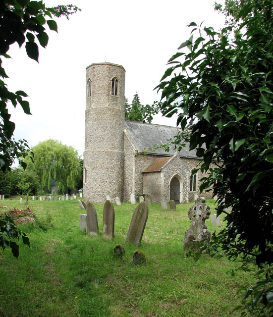
Image: © Evelyn Simak Taken: 22 Jun 2009
This is the view of St Mary's church from the public footpath which traverses the churchyard. The path leads from here to Norton's Farm, further to the south-west. St Mary's church > http://www.geograph.org.uk/photo/1366136 - http://www.geograph.org.uk/photo/1366177 - http://www.geograph.org.uk/photo/1366208 has a round tower which has not been dated exactly because it has characteristics of both Saxon and Norman architecture - most authorities take it to date from Norman times. The octagonal top was added in the 15th century. The south porch was built in the 15th century. The nave, which houses a C15 octagonal font > http://www.geograph.org.uk/photo/1366216 is thought to be older. The chancel > http://www.geograph.org.uk/photo/1366184 was built in the 13th century and has a Stuart communion table. The church was extensively restored in the late 1800s. St Mary's is open every day.
Images are licensed for reuse under creativecommons.org/licenses/by-sa/2.0
Image Location
Latitude
52.397722
Longitude
1.228756