IMAGES TAKEN NEAR TO
Swan Lane, HARLESTON, IP20 9AN

Introduction

This page details the photographs taken nearby to Swan Lane, IP20 9AN by members of the Geograph project.

The Geograph project started in 2005 with the aim of publishing, organising and preserving representative images for every square kilometre of Great Britain, Ireland and the Isle of Man.

There are currently over 7.5m images from over14,400 individuals and you can help contribute to the project by visiting https://www.geograph.org.uk

Image Map


Images are licensed for reuse under creativecommons.org/licenses/by-sa/2.0
Notes
  • Clicking on the map will re-center to the selected point.
  • The higher the marker number, the further away the image location is from the centre of the postcode.

Image Listing (155 Images Found)

Images are licensed for reuse under creativecommons.org/licenses/by-sa/2.0
  • ...
Image
Details
Distance
1
Harleston fire station
Harleston fire station, Swan Lane, Harleston, Norfolk
Image: © Kevin Hale Taken: 29 Jun 2010
0.05 miles
2
Swan Lane, Harleston
Approaching The Thoroughfare
Image: © Geographer Taken: 24 Mar 2015
0.05 miles
3
Harleston Telephone Exchange
On Paddock Road taken from Budgen's Supermarket Car Park
Image: © Geographer Taken: 17 Mar 2015
0.05 miles
4
Which Way Now ?
Direction sign Market Place Harleston Norfolk.
Image: © Keith Evans Taken: 22 Aug 2007
0.05 miles
5
Royal Mail The Thoroughfare Postbox
Postbox No.IP20 7131
Image: © Geographer Taken: 17 Jan 2012
0.06 miles
6
Royal Mail The Thoroughfare Postbox
Postbox No.IP20 7131
Image: © Geographer Taken: 17 Jan 2012
0.06 miles
7
Harleston Post Office & Royal Mail The Thoroughfare Postbox
Postbox No.IP20 7131
Image: © Geographer Taken: 17 Jan 2012
0.06 miles
8
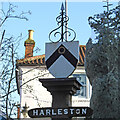
Harleston town sign
The sign is the town's crest, nothing more nothing less. It is also used by the Harleston Town Football Club with the addition of a football beneath the chevron. https://www.geograph.org.uk/photo/6676607
Image: © Adrian S Pye Taken: 15 Nov 2020
0.07 miles
9
Harleston town sign in the Market Place
The Christmas tree has been erected and is still wrapped. https://www.geograph.org.uk/photo/6676603
Image: © Adrian S Pye Taken: 15 Nov 2020
0.07 miles
10
Harleston: The Thoroughfare, looking south
Two parallel one-way streets make up the centre of Harleston: The Thoroughfare and Church Street. The plan of the town suggests that these probably form the two sides of a former market place, now filled in by the narrow strip of houses between those two roads.
Image: © Christopher Hilton Taken: 24 Apr 2021
0.07 miles
  • ...