
IMAGES TAKEN NEAR TO
North Parade, SOUTHWOLD, IP18 6LP
Introduction
This page details the photographs taken nearby to North Parade, IP18 6LP by members of the Geograph project.
The Geograph project started in 2005 with the aim of publishing, organising and preserving representative images for every square kilometre of Great Britain, Ireland and the Isle of Man.

There are currently over 7.5m images from over14,400 individuals and you can help contribute to the project by visiting https://www.geograph.org.uk
Image Map
Images are licensed for reuse under creativecommons.org/licenses/by-sa/2.0
Notes
- Clicking on the map will re-center to the selected point.
- The higher the marker number, the further away the image location is from the centre of the postcode.
Image Listing (1072 Images Found)
Images are licensed for reuse under creativecommons.org/licenses/by-sa/2.0
Image
Details
Distance
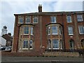
2
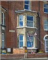
Southwold, 9 and 10 North Parade
According to the OS benchmark database there is a cutmark located in the same position as the white gas meter box on the wall that joins the 2 properties. It is unknown if the mark survives.
Image: © Mel Towler
Taken: 4 Jul 2022
0.01 miles
3
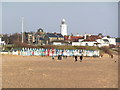
The seafront at Southwold
The beach huts here are very colourful.
Image: © N Chadwick
Taken: 31 Dec 2005
0.01 miles
4
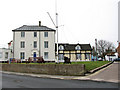
Houses by St James' Green, Southwold
This part of St James' Green was once the site of the coastgoard station and the original rigged mast was used for signalling. The 18th century barrels of the guns are castings that were recovered from merchant vessels which had foundered in Sole Bay.
Southwold is a seaside town on the Suffolk Heritage Coast. Almost an island, it is being bounded by the North Sea to the east, by the River Blyth and Southwold harbour to the south-west and by Buss Creek to the north, and there is only one road leading into and out of Southwold. Despite the Great Fire of 1659, which destroyed much of the town, many buildings of interest can still be seen. The fire created a number of open spaces, now greens, within the town. The town had a narrow-gauge Southwold Railway that connected to Halesworth and ran from the 24 September 1879 to April 1929. It has a lighthouse, a pier, and a sand and shingle beach that is protected by a number of sturdy new groynes. Southwold was the home of a number of Puritan emigrants to the Massachusetts Bay Colony in the early seventeenth century. In recent years an increasing number of houses have been bought as second homes, particularly by affluent Londoners.
Image: © Evelyn Simak
Taken: 4 Jan 2011
0.01 miles
5
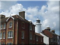
Southwold Lighthouse
The white lighthouse towering over the town. There is a large mix of architecture ranging from the small fisherman's cottages to the large mansions and 1960's flats.
Construction of the Lighthouse started in 1887. The lighthouse replaced 3 local lighthouses which needed to be replaced.
The present lighthouse lit up on the 3rd September 1890.
Specifications
Established 1889
Height Of Tower 31 Metres
Height Of Light Above Mean High Water 37 Metres
Automated 1938
Electrified 1938
Lamp 3 x 12v 90 Watt Osram Halostar
Optic 1st Order 920mm Focal Length, Catadioptric Fixed Lens
Character White And Red Group Flashing 4 Times Every 20 Seconds
Range Of Light White Main Light (220°-001°) 17 nautical miles
Red Light (204°-220° & 001°-032.3°) 15 nautical miles
Image: © Ashley Dace
Taken: 14 Jun 2009
0.01 miles
7

Lighthouse lens
For technical specification and history see http://www.trinityhouse.co.uk/interactive/gallery/southwold.html
Image: © Tiger
Taken: 1 Aug 2007
0.01 miles
9
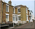
Cliff House, Southwold
Cliff House is situated on East Cliff, above Southwold Beach. It is a listed building > http://www.geograph.org.uk/photo/2220406.
Southwold is a seaside town on the Suffolk Heritage Coast. Almost an island, it is being bounded by the North Sea to the east, by the River Blyth and Southwold harbour to the south-west and by Buss Creek to the north, and there is only one road leading into and out of Southwold. Despite the Great Fire of 1659, which destroyed much of the town, many buildings of interest can still be seen. The fire created a number of open spaces, now greens, within the town. The town had a narrow-gauge Southwold Railway that connected to Halesworth and ran from the 24 September 1879 to April 1929. It has a lighthouse, a pier, and a sand and shingle beach that is protected by a number of sturdy new groynes. Southwold was the home of a number of Puritan emigrants to the Massachusetts Bay Colony in the early seventeenth century. In recent years an increasing number of houses have been bought as second homes, particularly by affluent Londoners.
Image: © Evelyn Simak
Taken: 4 Jan 2011
0.01 miles
10
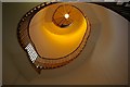
Staircase in Southwold lighthouse
Southwold lighthouse was begun in 1887 by Sir James Douglass, chief engineer to Trinity House. There are 92 steps in the first stage of the ascent.
Image: © Tiger
Taken: 1 Aug 2007
0.02 miles