Houses by St James' Green, Southwold
Introduction
The photograph on this page of Houses by St James' Green, Southwold by Evelyn Simak as part of the Geograph project.
The Geograph project started in 2005 with the aim of publishing, organising and preserving representative images for every square kilometre of Great Britain, Ireland and the Isle of Man.

There are currently over 7.5m images from over 14,400 individuals and you can help contribute to the project by visiting https://www.geograph.org.uk
Houses by St James' Green, Southwold
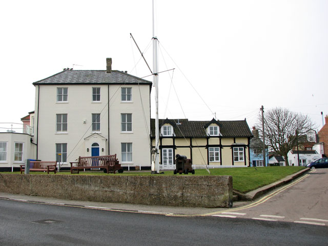
Image: © Evelyn Simak Taken: 4 Jan 2011
This part of St James' Green was once the site of the coastgoard station and the original rigged mast was used for signalling. The 18th century barrels of the guns are castings that were recovered from merchant vessels which had foundered in Sole Bay. Southwold is a seaside town on the Suffolk Heritage Coast. Almost an island, it is being bounded by the North Sea to the east, by the River Blyth and Southwold harbour to the south-west and by Buss Creek to the north, and there is only one road leading into and out of Southwold. Despite the Great Fire of 1659, which destroyed much of the town, many buildings of interest can still be seen. The fire created a number of open spaces, now greens, within the town. The town had a narrow-gauge Southwold Railway that connected to Halesworth and ran from the 24 September 1879 to April 1929. It has a lighthouse, a pier, and a sand and shingle beach that is protected by a number of sturdy new groynes. Southwold was the home of a number of Puritan emigrants to the Massachusetts Bay Colony in the early seventeenth century. In recent years an increasing number of houses have been bought as second homes, particularly by affluent Londoners.
Images are licensed for reuse under creativecommons.org/licenses/by-sa/2.0
Image Location
Latitude
52.327684
Longitude
1.682554