
IMAGES TAKEN NEAR TO
Bruisyard, SAXMUNDHAM, IP17 2EJ
Introduction
This page details the photographs taken nearby to IP17 2EJ by members of the Geograph project.
The Geograph project started in 2005 with the aim of publishing, organising and preserving representative images for every square kilometre of Great Britain, Ireland and the Isle of Man.

There are currently over 7.5m images from over14,400 individuals and you can help contribute to the project by visiting https://www.geograph.org.uk
Image Map
Images are licensed for reuse under creativecommons.org/licenses/by-sa/2.0
Notes
- Clicking on the map will re-center to the selected point.
- The higher the marker number, the further away the image location is from the centre of the postcode.
Image Listing (39 Images Found)
Images are licensed for reuse under creativecommons.org/licenses/by-sa/2.0
Image
Details
Distance
1
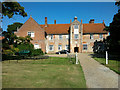
Bruisyard Hall
Front of Bruisyard Hall
http://www.bruisyardhall.co.uk/
Image: © Tim Marchant
Taken: 9 Sep 2012
0.00 miles
2
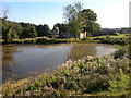
Bruisyard Hall
Rear of Bruisyard Hall from the lake.
http://www.bruisyardhall.co.uk/
Image: © Tim Marchant
Taken: 9 Sep 2012
0.01 miles
3
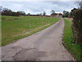
Bruisyard Hall
This ancient building is available for hire for functions.
Image: © John Goldsmith
Taken: 22 Feb 2009
0.03 miles
4
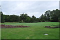
Site of Bruisyard Abbey
The cloisters and moat.
Image: © Ashley Dace
Taken: 8 Sep 2011
0.04 miles
5
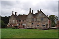
Bruisyard Hall
A view of the main hall. The part to the right is the oldest section with possible woodwork of Rooks hall and the abbey (see below). The main body is from the 1570s. The abbey cloisters and buildings were sited where I was standing. Please note the site is private without arrangement. Photography with permission.
Image: © Ashley Dace
Taken: 8 Sep 2011
0.05 miles
6
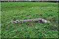
Flint remains
Possible abbey remains in a field outsite the hall.
Please note the site is private without arrangement. Photography with permission.
Image: © Ashley Dace
Taken: 8 Sep 2011
0.05 miles
7
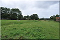
Earthworks at Bruisyard
The former abbey earthworks including leats and stable buildings.
Please note the site is private without arrangement. Photography with permission.
Image]
Image: © Ashley Dace
Taken: 8 Sep 2011
0.06 miles
8
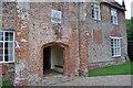
Bruisyard Hall
The front entrance from the 1570s. The blocked windows are evident, high up which shows someone wanted some privacy. The coat of arms of the Roos family can be seen above the porch.
Please note the site is private without arrangement. Photography with permission.
Image: © Ashley Dace
Taken: 8 Sep 2011
0.06 miles
9
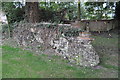
Bruisyard Hall - Chapel Remains
Possible chapel remains, an old map puts it here but archeological evidence is needed.
Please note the site is private without arrangement. Photography with permission.
Image: © Ashley Dace
Taken: 8 Sep 2011
0.07 miles
10

Bruisyard Hall
A view of the main hall. The part to the left is the oldest section with possible woodwork of Rooks hall and the abbey (see below). The main body is from the 1570s.
Image: © Ashley Dace
Taken: 8 Sep 2011
0.07 miles