
IMAGES TAKEN NEAR TO
Sandy Lane, LEISTON, IP16 4UJ
Introduction
This page details the photographs taken nearby to Sandy Lane, IP16 4UJ by members of the Geograph project.
The Geograph project started in 2005 with the aim of publishing, organising and preserving representative images for every square kilometre of Great Britain, Ireland and the Isle of Man.

There are currently over 7.5m images from over14,400 individuals and you can help contribute to the project by visiting https://www.geograph.org.uk
Image Map
Images are licensed for reuse under creativecommons.org/licenses/by-sa/2.0
Notes
- Clicking on the map will re-center to the selected point.
- The higher the marker number, the further away the image location is from the centre of the postcode.
Image Listing (15 Images Found)
Images are licensed for reuse under creativecommons.org/licenses/by-sa/2.0
Image
Details
Distance
1
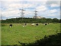
Cattle grazing by Sizewell power station
The site of Sizewell A (at right) occupies 245 acres of land north of Sizewell. The station was opened on 7 Aptil 1967 and has produced 110 TWh or electricity during its 40 year operational lifetime - sufficient to meet the domestic needs of England and Wales for 6 months. The power station was shut down on 31 December 2006.
Image: © Evelyn Simak
Taken: 14 Aug 2011
0.13 miles
2
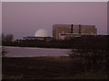
The lesser of two evils?
Do these look threatening, Sizewell A and B? To some. But set against the threat of global climate chaos, localised radiation hazards may be seen to be a necessary lesser of two evils. See also Image
Image: © Zorba the Geek
Taken: 29 Dec 2007
0.13 miles
3
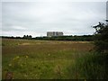
Looking towards Sizewell powerstation
Looking towards the pressurised water reactor of Sizewell B.
Image: © DS Pugh
Taken: 28 Jul 2012
0.15 miles
4
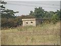
A Suffolk Square pillbox at Sizewell
This is a standard 'Suffolk Square' with a covered entrance blast wall and no ricochet wall.
Image: © Adrian S Pye
Taken: 14 Sep 2014
0.16 miles
5
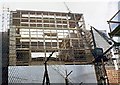
Close up to Construction
Part of the construction of Sizewell Power Station. Not until you are close up can you see just how large everything is.
Image: © Clive Warneford
Taken: Unknown
0.16 miles
6
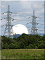
View across marsh pasture by Rookyard Wood
The large white dome of Sizewell B power station, flanked by huge electricity pylons, dominate the scenery here. Sizewell B is the UK's only commercial pressurised water reactor (PWR) power station, with a single reactor. It was built and commissioned between 1987 and 1995 and first synchronised with the national grid on 14 Feb 1995. The power station is operated by EDF Energy.
Image: © Evelyn Simak
Taken: 14 Aug 2011
0.17 miles
7
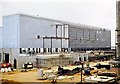
Construction Site
Sizewell Nuclear Power Station under construction, there were no restrictions to photographers way back in 1963, other than keeping out of the working areas.
Image: © Clive Warneford
Taken: Unknown
0.17 miles
8
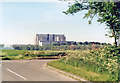
Sizewell A (Magnox) Nuclear Power Station, 1985
View from Sizewell Hall Road to the south, before Sizewell B was built.
Image: © Ben Brooksbank
Taken: 2 Jun 1985
0.18 miles
9
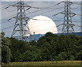
Sizewell B power station
This view was taken from Rookyard Wood, to the south-west of the power station. Sizewell B is the UK's only commercial pressurised water reactor (PWR) power station, with a single reactor. It was built and commissioned between 1987 and 1995 and first synchronised with the national grid on 14 Feb 1995. The power station is operated by EDF Energy.
Image: © Evelyn Simak
Taken: 14 Aug 2011
0.19 miles
10
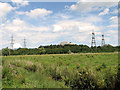
Ditch in marsh pasture by Rookyard Wood, Sizewell
Sizewell A and B power stations can be seen in the background. The large white dome of Sizewell B power station, flanked by huge electricity pylons, dominates the scenery here. Sizewell B is the UK's only commercial pressurised water reactor (PWR) power station, with a single reactor. It was built and commissioned between 1987 and 1995 and first synchronised with the national grid on 14 Feb 1995. The power station is operated by EDF Energy.
The site of Sizewell A occupies 245 acres of land north of Sizewell. The station was opened on 7 Aptil 1967 and has produced 110 TWh or electricity during its 40 year operational lifetime - sufficient to meet the domestic needs of England and Wales for 6 months. The power station was shut down on 31 December 2006.
Image: © Evelyn Simak
Taken: 14 Aug 2011
0.19 miles