
IMAGES TAKEN NEAR TO
LEISTON, IP16 4RH
Introduction
This page details the photographs taken nearby to IP16 4RH by members of the Geograph project.
The Geograph project started in 2005 with the aim of publishing, organising and preserving representative images for every square kilometre of Great Britain, Ireland and the Isle of Man.

There are currently over 7.5m images from over14,400 individuals and you can help contribute to the project by visiting https://www.geograph.org.uk
Image Map
Images are licensed for reuse under creativecommons.org/licenses/by-sa/2.0
Notes
- Clicking on the map will re-center to the selected point.
- The higher the marker number, the further away the image location is from the centre of the postcode.
Image Listing (9 Images Found)
Images are licensed for reuse under creativecommons.org/licenses/by-sa/2.0
Image
Details
Distance
1
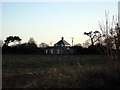
The Round House - rebuilt
Less than ten years ago, this was a derelict pair of farmworkers' cottages. Under the insistence of the planners, the central section of this new building preserves the appearance of the old, but single-storey extensions on three sides create a much larger footprint than two dwellings once had. SeeImage for the view from the south and Image for how it looked less than two years ago.
Image: © Zorba the Geek
Taken: 29 Dec 2007
0.01 miles
2
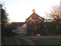
At the north end of the Back Road
stands the rebuilt Round House. Compare Image for a north-western viewpoint and full details.
Image: © Zorba the Geek
Taken: 29 Dec 2007
0.02 miles
3
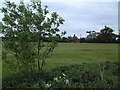
Field near Eastbridge
Across this field south of Eastbridge is a cottage known as "The Round House", which appears to be rectangular in plan although on a triangular plot. Currently derelict, there is evidence of building work now starting and no doubt within the year it will be occupied again.
Image: © David Squire
Taken: 21 May 2006
0.03 miles
4
Start of bridleway towards The Round House
This forms part of the Sandlings Walk.
Image: © Rob Noble
Taken: 28 Sep 2014
0.07 miles
5
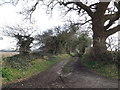
Bridleway to Lovers Lane & entrance to The Round House
Off Eastbridge Lane
Image: © Geographer
Taken: 11 Mar 2016
0.07 miles
6
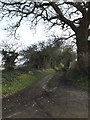
Bridleway to Lovers Lane & entrance to The Round House
Off Eastbridge Lane
Image: © Geographer
Taken: 11 Mar 2016
0.07 miles
7
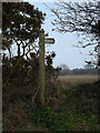
Bridleway sign on Eastbridge Lane
At the entrance to The Round House
Image: © Geographer
Taken: 11 Mar 2016
0.07 miles
8
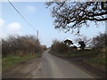
Eastbridge Lane & Bridleway
Near The Round House
Image: © Geographer
Taken: 11 Mar 2016
0.08 miles
9
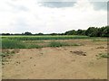
Arable fields south of Eastbridge Farm
Crop appears to be barley.
Image: © Stuart Logan
Taken: 25 Jun 2013
0.19 miles