
IMAGES TAKEN NEAR TO
Thorpeness, LEISTON, IP16 4QS
Introduction
This page details the photographs taken nearby to IP16 4QS by members of the Geograph project.
The Geograph project started in 2005 with the aim of publishing, organising and preserving representative images for every square kilometre of Great Britain, Ireland and the Isle of Man.

There are currently over 7.5m images from over14,400 individuals and you can help contribute to the project by visiting https://www.geograph.org.uk
Image Map
Images are licensed for reuse under creativecommons.org/licenses/by-sa/2.0
Notes
- Clicking on the map will re-center to the selected point.
- The higher the marker number, the further away the image location is from the centre of the postcode.
Image Listing (17 Images Found)
Images are licensed for reuse under creativecommons.org/licenses/by-sa/2.0
Image
Details
Distance
1
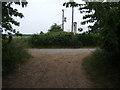
Footpath junction near Thorpeness
The path running left to right follows the course of a dismantled railway. The remains of a level crossing gate are still embedded in the hedge straight ahead.
Image: © Roger Miller
Taken: 25 Jun 2006
0.02 miles
2
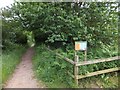
Sheepwash Crossing on former railway, Thorpeness
Sandlings Walk follows the former railway track
Image: © David Smith
Taken: 18 Jun 2014
0.02 miles
3
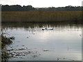
The Fens, North Warren Nature Reserve, Thorpeness, Suffolk
Swans enjoying a late autumn afternoon in cleared reedbeds.
Image: © Rodney Burton
Taken: 14 Nov 2012
0.06 miles
4
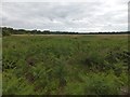
The Fens, west of Thorpeness
An area of open marsh and scrub, seen from the former railway track
Image: © David Smith
Taken: 18 Jun 2014
0.06 miles
5
The Fens, from the old railway line
Image: © Christopher Hilton
Taken: 8 Nov 2020
0.08 miles
6
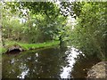
The western end of The Meare at Thorpeness
The artificial lake has several small islands at the western end; one is on the left
Image: © David Smith
Taken: 18 Jun 2014
0.08 miles
7
The Fens, from the old railway line
Image: © Christopher Hilton
Taken: 8 Nov 2020
0.08 miles
8
The Fens, from west of the old railway line
Image: © Christopher Hilton
Taken: 22 Nov 2020
0.10 miles
9
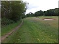
Bunkers on Thorpeness Golf Club
A footpath runs between the course and the Meare in the woodland on the left
Image: © David Smith
Taken: 18 Jun 2014
0.11 miles
10
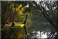
Island and channel in Thorpeness Meare
When the new resort of Thorpeness was laid out shortly before the First World War, The Meare was designed as a place where children could explore safely - a network of channels no more than a couple of feet deep ran between various islands at the head of the lake.
Image: © Christopher Hilton
Taken: 8 Nov 2020
0.11 miles