IMAGES TAKEN NEAR TO
The Green, STOWMARKET, IP14 6DH
Introduction
This page details the photographs taken nearby to The Green, IP14 6DH by members of the Geograph project.
The Geograph project started in 2005 with the aim of publishing, organising and preserving representative images for every square kilometre of Great Britain, Ireland and the Isle of Man.

There are currently over 7.5m images from over14,400 individuals and you can help contribute to the project by visiting https://www.geograph.org.uk
Image Map
Images are licensed for reuse under creativecommons.org/licenses/by-sa/2.0
Notes
- Clicking on the map will re-center to the selected point.
- The higher the marker number, the further away the image location is from the centre of the postcode.
Image Listing (76 Images Found)
Images are licensed for reuse under creativecommons.org/licenses/by-sa/2.0
Image
Details
Distance
1
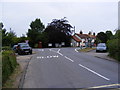
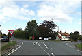
Ipswich Way, Pettaugh
At the junction with the A1120 Church Road
Image: © Geographer
Taken: 5 Jun 2011
0.01 miles
2
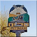
Pettaugh village sign
At the top is the old windmill which once stood where Mill Field is now. A farmer stands resting with his horse-drawn plough, representing the agricultural heritage of the parish. A tithe record book, the church of St Catherine and an anvil, representing the church and the blacksmith. https://www.geograph.org.uk/photo/4293697
Image: © Adrian S Pye
Taken: 12 Mar 2021
0.01 miles
3
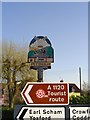
Pettaugh village sign almost lost among others
At the top is the old windmill which once stood where Mill Field is now. A farmer stands resting with his horse-drawn plough, representing the agricultural heritage of the parish. A tithe record book, the church of St Catherine and an anvil, representing the church and the blacksmith.
https://www.geograph.org.uk/photo/6775445
Image: © Adrian S Pye
Taken: 9 Nov 2007
0.01 miles
4
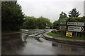
Complicated junction in Pettaugh
There are a few of these on the A1120, showing it was cobbled together from various other roads and forced through existing major roads going north to south.
Image: © David Howard
Taken: 27 Jul 2019
0.02 miles
5
C446 Ipswich Way, Pettaugh
At the junction with the A1120 Church Road
Image: © Geographer
Taken: 26 Sep 2015
0.02 miles
6
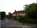
The former Bull Inn Pettaugh
This former pub stands next to the A1120 in the centre of the village, opposite the village shop. It closed in 1978.
Image: © Chris Holifield
Taken: 7 May 2011
0.02 miles
7
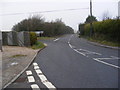
A1120 Church Road, Pettaugh
At the junction with Ipswich Road
Image: © Geographer
Taken: 16 Dec 2008
0.02 miles
8
A1120 Church Road, Pettaugh
Looking towards Stowmarket & Debenham at the junction with Ipswich Road
Image: © Geographer
Taken: 16 Dec 2008
0.02 miles
9
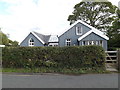
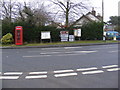
Pettaugh Village Hall
Off Ipswich Way at the junction with the A1120 Church Road
Image: © Geographer
Taken: 26 Sep 2015
0.02 miles
10
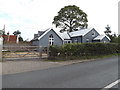
Pettaugh Village Hall
Off Ipswich Way at the junction with the A1120 Church Road
Image: © Geographer
Taken: 26 Sep 2015
0.02 miles