
IMAGES TAKEN NEAR TO
Spring Row, STOWMARKET, IP14 5AB
Introduction
This page details the photographs taken nearby to Spring Row, IP14 5AB by members of the Geograph project.
The Geograph project started in 2005 with the aim of publishing, organising and preserving representative images for every square kilometre of Great Britain, Ireland and the Isle of Man.

There are currently over 7.5m images from over14,400 individuals and you can help contribute to the project by visiting https://www.geograph.org.uk
Image Map
Images are licensed for reuse under creativecommons.org/licenses/by-sa/2.0
Notes
- Clicking on the map will re-center to the selected point.
- The higher the marker number, the further away the image location is from the centre of the postcode.
Image Listing (44 Images Found)
Images are licensed for reuse under creativecommons.org/licenses/by-sa/2.0
Image
Details
Distance
1
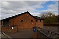
Stowmarket: Jehovah's Witnesses' Kingdom Hall
Image: © Christopher Hilton
Taken: 25 Mar 2019
0.04 miles
2
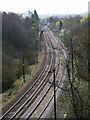
Western rail approach to Stowmarket
Two level crossings are visible - the first is in a minor residential street, the second (with car crossing it) is beside the station. The signal box and the station platform are visible behind the car.
Image: © John Goldsmith
Taken: 26 Mar 2009
0.07 miles
3
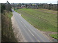
Western edge of Stowmarket
From the A14 viaduct.
Image: © John Goldsmith
Taken: 27 Mar 2009
0.08 miles
4
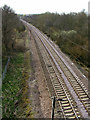
Rail lines west of Stowmarket station
Can a railway buff explain the odd grill mounted between the rails?
This photo was taken from the A14 viaduct which passes over 2 roads, a pair of railway tracks, one farm track, and a river.
The maps of the area just west of here are seriously incorrect since the Haughley Bends bypass was opened.
Image: © John Goldsmith
Taken: 26 Mar 2009
0.11 miles
5
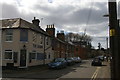
Crown Street, Stowmarket
On the left, the Crown pub from which the street presumably gets its name.
Image: © Christopher Hilton
Taken: 25 Mar 2019
0.13 miles
7
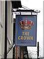
The hanging sign of 'The Crown' public house
http://www.geograph.org.uk/photo/5361622
Image: © Adrian S Pye
Taken: 23 Apr 2017
0.14 miles
8
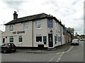
'The Crown' public house, Stowmarket
On the corner of Regent Street and Crown Street; how very appropriate.
http://www.geograph.org.uk/photo/5361626
Image: © Adrian S Pye
Taken: 23 Apr 2017
0.14 miles
9
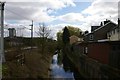
Stowmarket: River Gipping between Regent Street and the railway
At the extreme top left, a security camera watches over the Crown Street level crossing.
Image: © Christopher Hilton
Taken: 25 Mar 2019
0.14 miles
10
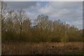
Stowmarket: damp woodland in the valley floor
The trees mask the railway line. A watercourse (marked on the map simply as "Drain") runs through this wet valley floor and down to the River Gipping near the station: judging by the map, this is probably the original course of the river which was then straightened out at the time of the railway's construction, put into a new cut to the west of the railway to avoid the track having to cross and re-cross the water. The new cut, if that is what it is, can be seen at Image
Image: © Christopher Hilton
Taken: 25 Mar 2019
0.15 miles