
IMAGES TAKEN NEAR TO
Stowmarket Road, STOWMARKET, IP14 3JP
Introduction
This page details the photographs taken nearby to Stowmarket Road, IP14 3JP by members of the Geograph project.
The Geograph project started in 2005 with the aim of publishing, organising and preserving representative images for every square kilometre of Great Britain, Ireland and the Isle of Man.

There are currently over 7.5m images from over14,400 individuals and you can help contribute to the project by visiting https://www.geograph.org.uk
Image Map
Images are licensed for reuse under creativecommons.org/licenses/by-sa/2.0
Notes
- Clicking on the map will re-center to the selected point.
- The higher the marker number, the further away the image location is from the centre of the postcode.
Image Listing (118 Images Found)
Images are licensed for reuse under creativecommons.org/licenses/by-sa/2.0
Image
Details
Distance
1
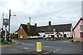
The Maypole
Judging by the weeds in the car park the pub has been closed for a little while now
Image: © John Myers
Taken: 28 May 2014
0.06 miles
4
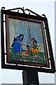
The Maypole, Wetherden
Pub sign. The Maypole was closed at the time this photo was taken but has since reopened under new management. Hopefully they've had the sign touched up!
Image: © John Myers
Taken: 28 May 2014
0.07 miles
5
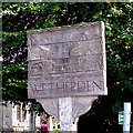
Wetherden village sign
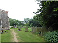
The sign can be found immediately outside the church gate.
It is very difficult to see what is on the sign, it looks just like a plank from a distance. Top left is a ploughed field and a windmill on the horizon. In the centre is the church tower, with farm animals in the foreground. Bottom right is the Baptist chapel. That is about all I can positively identify, which is a pity because I’m sure it has a lot more to show. Inscribed vertically on the post are the words "Erected by Wetherden Gardening Club 1987 based in a design by Stefan Oliver." https://www.geograph.org.uk/photo/6787264
Image: © Adrian S Pye
Taken: 23 Sep 2008
0.07 miles
6
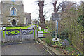
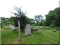
Wetherden village sign
It is very difficult to see what is on the sign, it looks just like a plank from a distance. Top left is a ploughed field and a windmill on the horizon. In the centre is the church tower, with farm animals in the foreground. Bottom right is the Baptist chapel. That is about all I can positively identify, which is a pity because I’m sure it has a lot more to show. Inscribed vertically on the post are the words "Erected by Wetherden Gardening Club 1987 based in a design by Stefan Oliver." https://www.geograph.org.uk/photo/4295618
How it should look - https://www.flickr.com/photos/brokentaco/504108932/
Image: © Adrian S Pye
Taken: 14 Mar 2021
0.07 miles
10
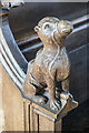
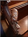
St Mary the Virgin, Wetherden - Bench end
Image: © John Salmon
Taken: 8 Apr 2019
0.08 miles