IMAGES TAKEN NEAR TO
Auction Yard, STOWMARKET, IP14 3GA
Introduction
This page details the photographs taken nearby to Auction Yard, IP14 3GA by members of the Geograph project.
The Geograph project started in 2005 with the aim of publishing, organising and preserving representative images for every square kilometre of Great Britain, Ireland and the Isle of Man.

There are currently over 7.5m images from over14,400 individuals and you can help contribute to the project by visiting https://www.geograph.org.uk
Image Map
Images are licensed for reuse under creativecommons.org/licenses/by-sa/2.0
Notes
- Clicking on the map will re-center to the selected point.
- The higher the marker number, the further away the image location is from the centre of the postcode.
Image Listing (157 Images Found)
Images are licensed for reuse under creativecommons.org/licenses/by-sa/2.0
Image
Details
Distance
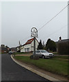
4
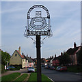
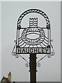
The High Street, Haughley, Suffolk
Haughley sign depicts a motte and bailey castle built in late 11th century by Hugh de Montfort. The castle was seized by Crown in 1163. Captured after a short siege and destroyed in 1173 by rebels led by the Earl of Leicester, the keeper at the time being Ralph de Broc.” https://www.geograph.org.uk/photo/6764497
Image: © Adrian S Pye
Taken: 28 Sep 2008
0.04 miles
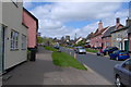
5
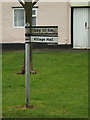
Roadsign on Old Street
At the junction with The Folly
Image: © Geographer
Taken: 3 Apr 2015
0.04 miles
6
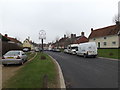
Old Street, Haughley
At the junction with The Folly
Image: © Geographer
Taken: 3 Apr 2015
0.05 miles
8
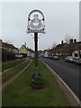
Haughley Village sign on Old Street
(Close up)
Image: © Geographer
Taken: 3 Apr 2015
0.05 miles
9
Haughley Village sign on Old Street
At the junction with The Folly
Image: © Geographer
Taken: 3 Apr 2015
0.05 miles
10
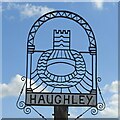
Haughley village sign
Haughley sign depicts a motte and bailey castle built in late 11th century by Hugh de Montfort. The castle was seized by Crown in 1163. Captured after a short siege and destroyed in 1173 by rebels led by the Earl of Leicester, the keeper at the time being Ralph de Broc.” https://www.geograph.org.uk/photo/2206893
Image: © Adrian S Pye
Taken: 26 Feb 2021
0.05 miles