
IMAGES TAKEN NEAR TO
Ringshall, STOWMARKET, IP14 2JA
Introduction
This page details the photographs taken nearby to IP14 2JA by members of the Geograph project.
The Geograph project started in 2005 with the aim of publishing, organising and preserving representative images for every square kilometre of Great Britain, Ireland and the Isle of Man.

There are currently over 7.5m images from over14,400 individuals and you can help contribute to the project by visiting https://www.geograph.org.uk
Image Map
Images are licensed for reuse under creativecommons.org/licenses/by-sa/2.0
Notes
- Clicking on the map will re-center to the selected point.
- The higher the marker number, the further away the image location is from the centre of the postcode.
Image Listing (13 Images Found)
Images are licensed for reuse under creativecommons.org/licenses/by-sa/2.0
Image
Details
Distance
1
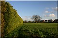
Ringshall footpath
This path runs east-west behind new houses at Ringshall, close to Chapel Farm.
Image: © Bob Jones
Taken: 17 Jan 2007
0.13 miles
3
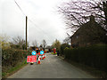
Roadworks in Ringshall
Laying fibre optic cables for BT
Image: © Adrian S Pye
Taken: 8 Apr 2015
0.21 miles
4
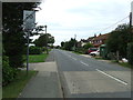
Lower Farm Road
Looking west along Lower Farm Road at Ringshall Stocks, Suffolk.
Image: © Keith Evans
Taken: 21 Aug 2011
0.22 miles
5
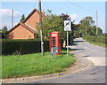
Telephone box and the start of the lane to Ringshall church
Very close to the gridline, but the 1:25,000 map places the box and the first 100 metres of the lane within the square.
Image: © Andrew Hill
Taken: 18 Sep 2008
0.22 miles
6
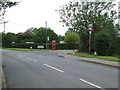
Crossroads
Village crossroads with telephone box and village sign at Ringshall Stocks, Suffolk for close up view of the village sign see http://www.geograph.org.uk/photo/2566540
Image: © Keith Evans
Taken: 21 Aug 2011
0.23 miles
7
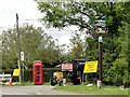
Roadworks in Ringshall near the village sign
The sign is surmounted by a miniature replica of a horse drawn plough in homage to the horse and the agricultural heritage of the village, Above the name a farmer and his dog watch a tractor working the field. Below the name a pair of heavy horses while a man rakes the last of the straw. The sign has foliage around the frame with blackbirds and a song thrush perching on the branches. The base of the sign is a replica of the village pillory. They stand in the area locally known as the Ringshall Stocks. The top of the post has a picture of St Catherine’s church and swifts flying overhead. The aircraft, a Mc Donald Douglas Phantom, is a reference to the past presence of the Royal Air Force at Wattisham and the helicopter, an Army Air Corps Apache, is a reference to the presence of the Army who now occupy the airfield. The policeman and other character are incidental and there to complete a picture of village life. https://www.geograph.org.uk/photo/6781333
Image: © Adrian S Pye
Taken: 30 May 2015
0.23 miles
8
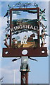
Ringshall village sign
An imaginative example.
Image: © Andrew Hill
Taken: 18 Sep 2008
0.23 miles
9
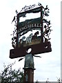
Ringshall Stocks Village Sign
Close up of the village sign at Ringshall Stocks, Suffolk for overall view see http://www.geograph.org.uk/photo/2566537
Image: © Keith Evans
Taken: 21 Aug 2011
0.24 miles
10
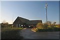
Ringshall village hall
The village hall is situated in the centre of the small village of Ringshall Stocks, known locally as simply 'Ringshall'.
Image: © Bob Jones
Taken: 17 Jan 2007
0.24 miles