Roadworks in Ringshall near the village sign
Introduction
The photograph on this page of Roadworks in Ringshall near the village sign by Adrian S Pye as part of the Geograph project.
The Geograph project started in 2005 with the aim of publishing, organising and preserving representative images for every square kilometre of Great Britain, Ireland and the Isle of Man.

There are currently over 7.5m images from over 14,400 individuals and you can help contribute to the project by visiting https://www.geograph.org.uk
Roadworks in Ringshall near the village sign
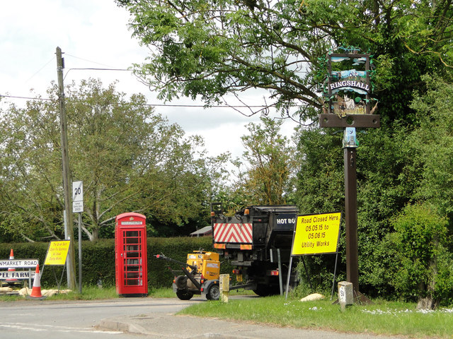
Image: © Adrian S Pye Taken: 30 May 2015
The sign is surmounted by a miniature replica of a horse drawn plough in homage to the horse and the agricultural heritage of the village, Above the name a farmer and his dog watch a tractor working the field. Below the name a pair of heavy horses while a man rakes the last of the straw. The sign has foliage around the frame with blackbirds and a song thrush perching on the branches. The base of the sign is a replica of the village pillory. They stand in the area locally known as the Ringshall Stocks. The top of the post has a picture of St Catherine’s church and swifts flying overhead. The aircraft, a Mc Donald Douglas Phantom, is a reference to the past presence of the Royal Air Force at Wattisham and the helicopter, an Army Air Corps Apache, is a reference to the presence of the Army who now occupy the airfield. The policeman and other character are incidental and there to complete a picture of village life. https://www.geograph.org.uk/photo/6781333
Images are licensed for reuse under creativecommons.org/licenses/by-sa/2.0
Image Location
Latitude
52.12368
Longitude
0.993666