
IMAGES TAKEN NEAR TO
STOWMARKET, IP14 1EY
Introduction
This page details the photographs taken nearby to IP14 1EY by members of the Geograph project.
The Geograph project started in 2005 with the aim of publishing, organising and preserving representative images for every square kilometre of Great Britain, Ireland and the Isle of Man.

There are currently over 7.5m images from over14,400 individuals and you can help contribute to the project by visiting https://www.geograph.org.uk
Image Map
Images are licensed for reuse under creativecommons.org/licenses/by-sa/2.0
Notes
- Clicking on the map will re-center to the selected point.
- The higher the marker number, the further away the image location is from the centre of the postcode.
Image Listing (51 Images Found)
Images are licensed for reuse under creativecommons.org/licenses/by-sa/2.0
Image
Details
Distance
1
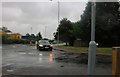
Hollingsworth Road at the junction of Gipping Way
Image: © David Howard
Taken: 27 Jul 2019
0.07 miles
2
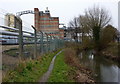
ICI paints factory by the River Gipping
There is a considerable amount of well established industrial activity by the river and railway. The footpath towards Ipswich follows the riverbank closely.
Image: © Andrew Hill
Taken: 1 Apr 2010
0.08 miles
3

Colourful factory, Stowmarket
Recently painted towers displaying some bright colours
Image: © Colin Park
Taken: 24 Jul 2011
0.10 miles
4
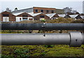
Industrial view from the Gipping footpath
A glimpse of factory buildings beyond the pathside pipelines.
Image: © Andrew Hill
Taken: 1 Apr 2010
0.11 miles
5
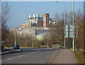
Gipping Way and Stowmarket industry
Looking along the road towards factories in the next square. The largest buildings in the background are those of ICI paints.
Image: © Andrew Hill
Taken: 17 Feb 2010
0.11 miles
6
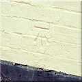
Cut Mark Stowmarket No 145 Lime Tree Place
Cut Mark Stowmarket No 145 Lime Tree Place SW face, S angle.
Image: © Cud05
Taken: 31 Mar 2018
0.13 miles
7
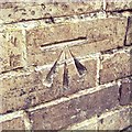
Cut Mark Stowmarket No 1 Lime Tree Place Wall
Cut Mark Stowmarket No 1 Lime Tree Place Wall.
Image: © Cud05
Taken: 31 Mar 2018
0.13 miles
8
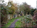
Gipping river footpath
The wall makes a change from the long distances with high wire fencing. This long industrial stretch makes for an interesting rather than attractive walk. There is a wide variety of plant life on the river bank.
Image: © Andrew Hill
Taken: 1 Apr 2010
0.15 miles
9
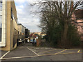
South side of The Mix by a track and lime trees, off Ipswich Street, Stowmarket
The street frontage of The Mix is seen in Image A map of 1927 shows malthouses and orchards down here. The lime trees must give their name to The Limes, the house on the right Image
Image: © Robin Stott
Taken: 5 Feb 2018
0.15 miles
10
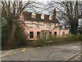
Pink-washed old house with a tiled roof, Ipswich Road, Stowmarket
Here framed by pollarded lime trees, it is named as The Limes on a map of the 1980s Image The broken piece of wood is assumed to be a damaged street nameplate for Ipswich Road.
Image: © Robin Stott
Taken: 5 Feb 2018
0.16 miles