
IMAGES TAKEN NEAR TO
Marriotts Walk, STOWMARKET, IP14 1AF
Introduction
This page details the photographs taken nearby to Marriotts Walk, IP14 1AF by members of the Geograph project.
The Geograph project started in 2005 with the aim of publishing, organising and preserving representative images for every square kilometre of Great Britain, Ireland and the Isle of Man.

There are currently over 7.5m images from over14,400 individuals and you can help contribute to the project by visiting https://www.geograph.org.uk
Image Map
Images are licensed for reuse under creativecommons.org/licenses/by-sa/2.0
Notes
- Clicking on the map will re-center to the selected point.
- The higher the marker number, the further away the image location is from the centre of the postcode.
Image Listing (385 Images Found)
Images are licensed for reuse under creativecommons.org/licenses/by-sa/2.0
Image
Details
Distance
1
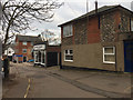
Premises on Marriotts Walk, Stowmarket
The single-storey building is Meredith Greengrass, Funeral Services, one of three or four such places in a small area.
Image: © Robin Stott
Taken: 5 Feb 2018
0.01 miles
2
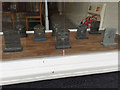
Types of 'granite' in a funeral director's window, Marriotts Walk, Stowmarket
In the window of Meredith Greengrass, Funeral Services.
Image: © Robin Stott
Taken: 5 Feb 2018
0.01 miles
3
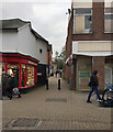
Marriotts Walk, off Ipswich Street, Stowmarket
It runs south-southwest up a gentle rise.
Image: © Robin Stott
Taken: 5 Feb 2018
0.02 miles
4
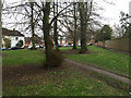
Open space with lime trees by Marriotts Walk, Stowmarket
A paved path hugs the wall; a well-worn desire line takes a shorter route. This and the grounds of Abbot's Hall over the wall were shown on OS maps as Camping Land between 1927 and 1958, before the appearance of the Guides' Hut (behind the camera Image).
Image: © Robin Stott
Taken: 5 Feb 2018
0.03 miles
5
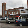
United Reformed Church, off Ipswich Street, Stowmarket
The present building was opened and dedicated in 1955. It replaced the church destroyed in an air raid in 1941. http://www.stowmarket-urc.org.uk/history.html
Next door is Co-op Funeral care, one of four funeral directors I noted in a brief visit to this small town centre.
Image: © Robin Stott
Taken: 5 Feb 2018
0.03 miles
6

Guides' Hut off Crowe Street, Stowmarket
Although it has a Great War feel, it doesn't appear on an OS map until 1968-9, as TA Centre. In 1974-5 it was shown as Guide Hut, and in 1983-91 as ?Hall. The small sign seen here says Stowmarket ?Rainbow Guides. I love the juxtaposition of the low-slung wooden hut and the big trees, notably the Wellingtonia or Giant Redwood in front, centre. In the distance on the right is the tower of the United Reformed Church Image
Image: © Robin Stott
Taken: 5 Feb 2018
0.03 miles
7
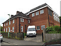
Stowmarket Telephone Exchange
Off Kensington Road
Image: © Geographer
Taken: 25 May 2016
0.04 miles

9
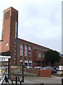
United Reformed Church
United Reformed Church, Stowmarket, Suffolk. For more info see www.suffolkchurches.co.uk/stowurc.htm
Image: © Keith Evans
Taken: 30 Jan 2011
0.04 miles
10
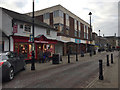
Shops on the west side of Ipswich Street, Stowmarket
Pedestrians and vehicles share a paved level surface but vehicles, going north only, are confined by bollards.
Image: © Robin Stott
Taken: 5 Feb 2018
0.04 miles