
IMAGES TAKEN NEAR TO
Framlingham Road, WOODBRIDGE, IP13 8BD
Introduction
This page details the photographs taken nearby to Framlingham Road, IP13 8BD by members of the Geograph project.
The Geograph project started in 2005 with the aim of publishing, organising and preserving representative images for every square kilometre of Great Britain, Ireland and the Isle of Man.

There are currently over 7.5m images from over14,400 individuals and you can help contribute to the project by visiting https://www.geograph.org.uk
Image Map
Images are licensed for reuse under creativecommons.org/licenses/by-sa/2.0
Notes
- Clicking on the map will re-center to the selected point.
- The higher the marker number, the further away the image location is from the centre of the postcode.
Image Listing (42 Images Found)
Images are licensed for reuse under creativecommons.org/licenses/by-sa/2.0
Image
Details
Distance
1
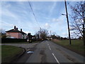
B1118 The Thoroughfare, Bundish
At the junction with Crown Corner
Image: © Geographer
Taken: 19 Feb 2019
0.03 miles
3
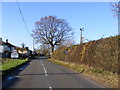
Entering Brundish on the B1118 The Thoroughfare
At Crown Corner
Image: © Geographer
Taken: 30 Nov 2011
0.05 miles
4
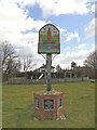
Brundish village sign and War Memorial
At the base of the village sign are the names of those from the village who never returned from both world wars. The names, as they appear: Herbert G. Burgess, Frederick Clements, George Cushion, Charles Feveyear, Harry Feveyear, Alfred J. Foster, David Green, William Howard, Thomas Kerry, Albert V. Leek, Frederick Leddett M.M., Reuben Lyon, William Pipe, Albert G. Rumsey, Frederick Rumsey, Harry Rumsey, Herbert Scase, Charles W. Smith, Percy J. Smith. 1939 -1945 James Abbott.http://www.geograph.org.uk/photo/4371091
Image: © Adrian S Pye
Taken: 4 Mar 2015
0.05 miles
5
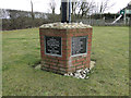
The village sign and War Memorial at Brundish
http://www.geograph.org.uk/photo/4371082
Image: © Adrian S Pye
Taken: 4 Mar 2015
0.05 miles
6
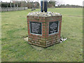
Village sign and War Memorial at Brundish
http://www.geograph.org.uk/photo/4371082
http://www.geograph.org.uk/photo/4371091
Image: © Adrian S Pye
Taken: 4 Mar 2015
0.05 miles
7
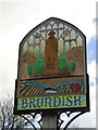
The village sign at Brundish (detail)
The shape of the sign and background is likened to the east window in the parish church of St Lawrence and even includes a stained glass panel showing the crowned head of a king and a hairy demonic fellow sticking out his tongue. In the centre stands Sir Edmund de Brundish, featured on a brass in the church from the latter half of the 14th century. The depiction of wheat and barley sheaves and a plough and ploughed field below signify our close ties with the land. The panel with the name illustrated the River Alde meandering through green meadows. http://www.geograph.org.uk/photo/4371082
Image: © Adrian S Pye
Taken: 4 Mar 2015
0.05 miles
8
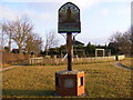
Brundish Village Sign
Off Tannington Long Lane at the junction with the B1118 The Thoroughfare
Image: © Geographer
Taken: 28 Dec 2008
0.06 miles
9
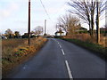
B1118 The Thoroughfare
Looking towards Brundish
Image: © Geographer
Taken: 28 Dec 2008
0.07 miles
10

Brundish Village Sign
Off Tannington Long Lane at the junction with the B1118 The Thoroughfare
Image: © Geographer
Taken: 28 Dec 2008
0.07 miles