The village sign at Brundish (detail)
Introduction
The photograph on this page of The village sign at Brundish (detail) by Adrian S Pye as part of the Geograph project.
The Geograph project started in 2005 with the aim of publishing, organising and preserving representative images for every square kilometre of Great Britain, Ireland and the Isle of Man.

There are currently over 7.5m images from over 14,400 individuals and you can help contribute to the project by visiting https://www.geograph.org.uk
The village sign at Brundish (detail)
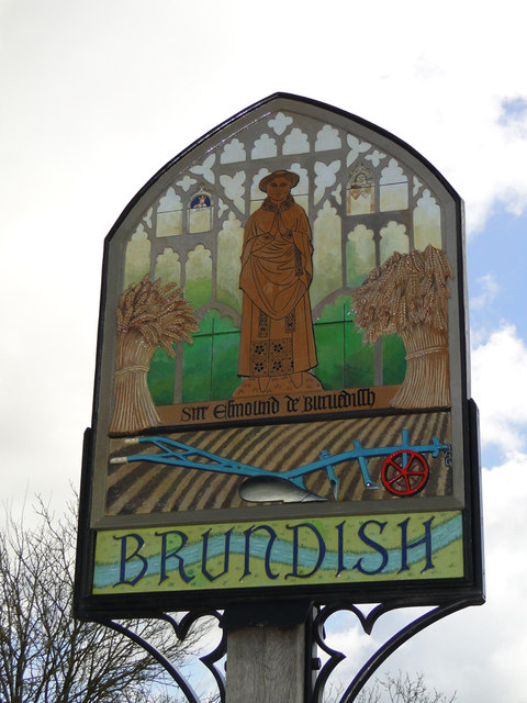
Image: © Adrian S Pye Taken: 4 Mar 2015
The shape of the sign and background is likened to the east window in the parish church of St Lawrence and even includes a stained glass panel showing the crowned head of a king and a hairy demonic fellow sticking out his tongue. In the centre stands Sir Edmund de Brundish, featured on a brass in the church from the latter half of the 14th century. The depiction of wheat and barley sheaves and a plough and ploughed field below signify our close ties with the land. The panel with the name illustrated the River Alde meandering through green meadows. http://www.geograph.org.uk/photo/4371082
Images are licensed for reuse under creativecommons.org/licenses/by-sa/2.0
Image Location
Latitude
52.28282
Longitude
1.305298