
IMAGES TAKEN NEAR TO
Portmans Walk, IPSWICH, IP1 2DW
Introduction
This page details the photographs taken nearby to Portmans Walk, IP1 2DW by members of the Geograph project.
The Geograph project started in 2005 with the aim of publishing, organising and preserving representative images for every square kilometre of Great Britain, Ireland and the Isle of Man.

There are currently over 7.5m images from over14,400 individuals and you can help contribute to the project by visiting https://www.geograph.org.uk
Image Map
Images are licensed for reuse under creativecommons.org/licenses/by-sa/2.0
Notes
- Clicking on the map will re-center to the selected point.
- The higher the marker number, the further away the image location is from the centre of the postcode.
Image Listing (246 Images Found)
Images are licensed for reuse under creativecommons.org/licenses/by-sa/2.0
Image
Details
Distance
1
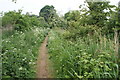
Footpath alongside the disused Alderman canal
Image: © Oxymoron
Taken: 14 May 2009
0.04 miles
2
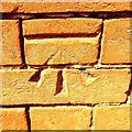
Cut Mark Ipswich Sir Alf Ramsey Way Storage Unit
Cut Mark Ipswich Sir Alf Ramsey Way Storage Unit S face, SE angle.
Image: © Cud05
Taken: 12 Jun 2017
0.06 miles
4
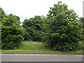
Trees on Bibb Way
Alderman Road recreation ground is behind.
Image: © Hamish Griffin
Taken: 26 May 2014
0.07 miles
5
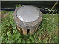
"Object" on Bibb Way
Maybe this was once a bin. The boundary for John Davis & Son Funfairs camp area can be seen behind.
Image: © Hamish Griffin
Taken: 26 May 2014
0.07 miles
6
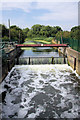
Handford Sea Lock
This disused lock, now a weir, was the final lock of 15 between Stowmarket and Ipswich when the River Gipping was navigable as the 'Stowmarket Navigation', until 1920. This view is upstream, towards Stowmarket.
Image: © Bob Jones
Taken: 6 Aug 2008
0.07 miles
7
Sir Alf Ramsey Way
Named after the England World Cup Winning manager.
Image: © N Chadwick
Taken: 18 Sep 2011
0.08 miles
8
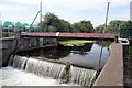
Weir at Handford Sea Lock
This weir has replaced the former lock, which was the final lock of the Stowmarket Navigation. The water beyond the weir is a canalised section of the River Gipping.
Image: © Bob Jones
Taken: 6 Aug 2008
0.08 miles
10
Flood barrier, River Gipping
This flood barrier has been erected at the site of the former bottom lock of the Ipswich and Stowmarket Navigation.
Image: © N Chadwick
Taken: 18 Sep 2011
0.08 miles