Handford Sea Lock
Introduction
The photograph on this page of Handford Sea Lock by Bob Jones as part of the Geograph project.
The Geograph project started in 2005 with the aim of publishing, organising and preserving representative images for every square kilometre of Great Britain, Ireland and the Isle of Man.

There are currently over 7.5m images from over 14,400 individuals and you can help contribute to the project by visiting https://www.geograph.org.uk
Handford Sea Lock
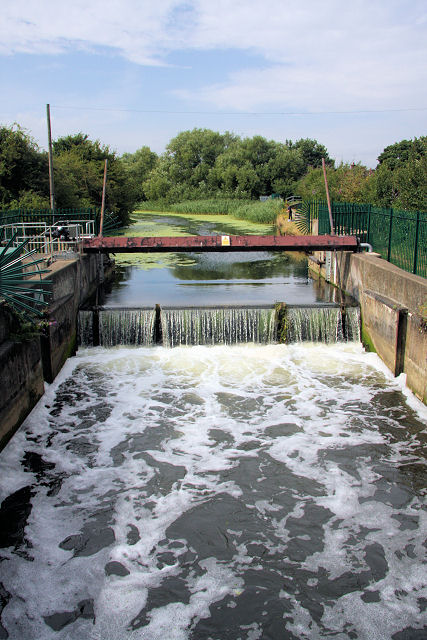
Image: © Bob Jones Taken: 6 Aug 2008
This disused lock, now a weir, was the final lock of 15 between Stowmarket and Ipswich when the River Gipping was navigable as the 'Stowmarket Navigation', until 1920. This view is upstream, towards Stowmarket.
Images are licensed for reuse under creativecommons.org/licenses/by-sa/2.0
Image Location


Leaflet Map data © OpenStreetMap
Latitude
52.055258
Longitude
1.138042