IMAGES TAKEN NEAR TO
Mill Lane, WOODBRIDGE, IP12 4PD
Introduction
This page details the photographs taken nearby to Mill Lane, IP12 4PD by members of the Geograph project.
The Geograph project started in 2005 with the aim of publishing, organising and preserving representative images for every square kilometre of Great Britain, Ireland and the Isle of Man.

There are currently over 7.5m images from over14,400 individuals and you can help contribute to the project by visiting https://www.geograph.org.uk
Image Map
Images are licensed for reuse under creativecommons.org/licenses/by-sa/2.0
Notes
- Clicking on the map will re-center to the selected point.
- The higher the marker number, the further away the image location is from the centre of the postcode.
Image Listing (25 Images Found)
Images are licensed for reuse under creativecommons.org/licenses/by-sa/2.0
Image
Details
Distance
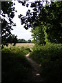
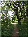
1
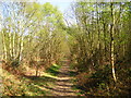
The Sandlings Walk Path
I believe this area of coppiced woodland is called Doctor Britton's wood
Image: © Chris Holifield
Taken: 8 Apr 2011
0.13 miles
2
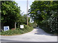
Mill Lane Restricted Byway to Nutbourne Road & Entrance to the Martlesham RSPCA Centre
Off Felixstowe Road
Image: © Geographer
Taken: 6 May 2011
0.16 miles
3
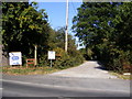
Mill Lane Restricted Byway to Newbourne Road & Entrance to the RSPCA Martlesham Branch
Off Felixstowe Road
Image: © Geographer
Taken: 27 Aug 2009
0.17 miles
4
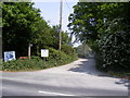
Mill Lane Restricted Byway to Nutbourne Road & Entrance to the Martlesham RSPCA Centre
Off Felixstowe Road
Image: © Geographer
Taken: 6 May 2011
0.17 miles
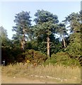
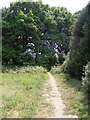
5
Footpath to the A12 Martlesham Bypass over Martlesham Heath
Off Felixstowe Road near Mill Farm
Image: © Geographer
Taken: 13 May 2011
0.19 miles
7
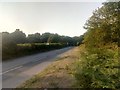
Felixstowe Road, Martlesham
This road is a cycle priority route, with broad cycle lanes on either side which motor vehicles can only enter if no cyclists are near.
Taken from the car park where the Sandlings Walk crosses the road.
Image: © Christopher Hilton
Taken: 25 Jul 2019
0.20 miles
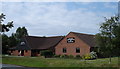
8
Woodland, Martlesham Heath
Taken from the car park where the Sandlings Walk crosses the road.
Image: © Christopher Hilton
Taken: 25 Jul 2019
0.20 miles
9
Footpath to the A12 Martlesham Bypass over Martlesham Heath
Off Felixstowe Road near Mill Farm
Image: © Geographer
Taken: 13 May 2011
0.20 miles
10
Footpath to the A12 Martlesham Bypass over Martlesham Heath
Off Felixstowe Road near Mill Farm
Image: © Geographer
Taken: 13 May 2011
0.20 miles