IMAGES TAKEN NEAR TO
Lamberts Lane, WOODBRIDGE, IP12 2HB
Introduction
This page details the photographs taken nearby to Lamberts Lane, IP12 2HB by members of the Geograph project.
The Geograph project started in 2005 with the aim of publishing, organising and preserving representative images for every square kilometre of Great Britain, Ireland and the Isle of Man.

There are currently over 7.5m images from over14,400 individuals and you can help contribute to the project by visiting https://www.geograph.org.uk
Image Map
Images are licensed for reuse under creativecommons.org/licenses/by-sa/2.0
Notes
- Clicking on the map will re-center to the selected point.
- The higher the marker number, the further away the image location is from the centre of the postcode.
Image Listing (14 Images Found)
Images are licensed for reuse under creativecommons.org/licenses/by-sa/2.0
Image
Details
Distance
1
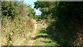
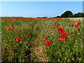
A walk to the River Alde, Suffolk
This photograph shows the public footpath that leads to Westrow Reach on the River Alde in Suffolk. Approximately 100m behind the photographer’s viewpoint is the point at which the track/public footpath divided, one branch (the track) leading north to Cowton Farm and this branch (the footpath) continuing on towards the river. The OS map records this as a track almost all the way to the river, however just a little further ahead the path becomes impassable to any vehicle except, perhaps, a bicycle.
Image: © Alan Walker
Taken: 15 Jul 2006
0.05 miles
3
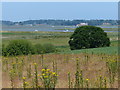
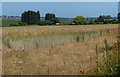
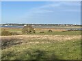
Looking over arable land to the Alde Valley, Sudbourne
Arable land near Ferry Farm, with the River Alde Valley in the distance.
Image: © Roger Jones
Taken: 23 Aug 2014
0.06 miles
4
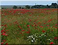
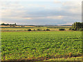
Farmland near Cowton House
Looking north from Ferry Lane towards Iken Marshes.
Image: © Simon Mortimer
Taken: 4 Dec 2021
0.08 miles
5
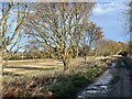
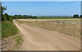
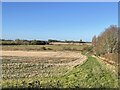
Ferry Lane near Cowton House
Looking north-east, Cowton House can be seen in the distance.
Image: © Simon Mortimer
Taken: 4 Dec 2021
0.10 miles
6
The Alde estuary from Ferry Lane
Looking north from a point close to Cowton House.
Image: © Simon Mortimer
Taken: 4 Dec 2021
0.16 miles