IMAGES TAKEN NEAR TO
Stag Lane, BUCKHURST HILL, IG9 5TD
Introduction
This page details the photographs taken nearby to Stag Lane, IG9 5TD by members of the Geograph project.
The Geograph project started in 2005 with the aim of publishing, organising and preserving representative images for every square kilometre of Great Britain, Ireland and the Isle of Man.

There are currently over 7.5m images from over14,400 individuals and you can help contribute to the project by visiting https://www.geograph.org.uk
Image Map
Images are licensed for reuse under creativecommons.org/licenses/by-sa/2.0
Notes
- Clicking on the map will re-center to the selected point.
- The higher the marker number, the further away the image location is from the centre of the postcode.
Image Listing (57 Images Found)
Images are licensed for reuse under creativecommons.org/licenses/by-sa/2.0
Image
Details
Distance
2
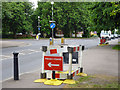
Pedestrian obstacles, High Road, Buckhurst Hill
The direction signs seem rather superfluous.
Image: © Robin Webster
Taken: 2 Jun 2012
0.08 miles
3
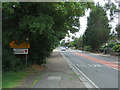
Entering Essex
Looking north on Epping New Road (A104).
Image: © JThomas
Taken: 5 Aug 2017
0.09 miles
4
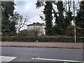
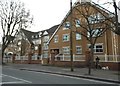
Tooley & Foster architects on High Road, Buckhurst Hill
Image: © David Howard
Taken: 21 Nov 2021
0.10 miles
5
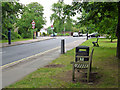
Benches on Queen's Road
Possible placed at the top of the hill up from the shops and the station for the less fit to recover.
Image: © Robin Webster
Taken: 2 Jun 2012
0.10 miles
6
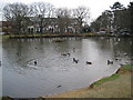
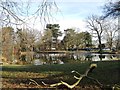
Buckhurst Hill: St John's Pond
This popular pond is located to the south of St John's Church, on the west side of the A121 High Road. The houses beyond the trees are in Osborne Road.
Image: © Nigel Cox
Taken: 4 Jan 2008
0.11 miles
7
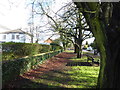
At the top of Queen's Road
High Road, Woodford Green is just behind where I am standing. Ahead Queen's Road drops down to Buckhurst Hill station and the Roding Valley.
Image: © Marathon
Taken: 7 Feb 2017
0.12 miles
9
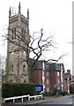
Buckhurst Hill: Former Congregational Church Tower
Not being a local I am a little mystified by this tower in Palmerston Road. It was certainly built as part of the Congregational Church in 1873, designed by the architect Edmond Egan. There is a photo dated 1923 in the Francis Frith collection http://www.francisfrith.com/search/england/essex/buckhurst+hill/photos/buckhurst+hill_73931.htm of the tower with the church behind, but searching via Google fails to reveal why the body of the church was subsequently demolished. Was it damaged by a bomb, was the building unsound, or were the maintenance costs too high? Today some 1980s flats have replaced the church and somewhat incongruously abut the tower on its eastern side, while the view of the four slender corner turrets is totally ruined by the festooned mobile phone masts...
Image: © Nigel Cox
Taken: 4 Jan 2008
0.15 miles