Buckhurst Hill: Former Congregational Church Tower
Introduction
The photograph on this page of Buckhurst Hill: Former Congregational Church Tower by Nigel Cox as part of the Geograph project.
The Geograph project started in 2005 with the aim of publishing, organising and preserving representative images for every square kilometre of Great Britain, Ireland and the Isle of Man.

There are currently over 7.5m images from over 14,400 individuals and you can help contribute to the project by visiting https://www.geograph.org.uk
Buckhurst Hill: Former Congregational Church Tower
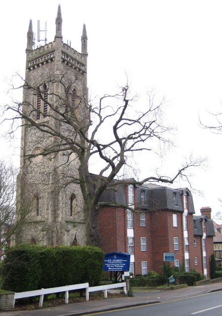
Image: © Nigel Cox Taken: 4 Jan 2008
Not being a local I am a little mystified by this tower in Palmerston Road. It was certainly built as part of the Congregational Church in 1873, designed by the architect Edmond Egan. There is a photo dated 1923 in the Francis Frith collection http://www.francisfrith.com/search/england/essex/buckhurst+hill/photos/buckhurst+hill_73931.htm of the tower with the church behind, but searching via Google fails to reveal why the body of the church was subsequently demolished. Was it damaged by a bomb, was the building unsound, or were the maintenance costs too high? Today some 1980s flats have replaced the church and somewhat incongruously abut the tower on its eastern side, while the view of the four slender corner turrets is totally ruined by the festooned mobile phone masts...
Images are licensed for reuse under creativecommons.org/licenses/by-sa/2.0
Image Location
Latitude
51.626282
Longitude
0.034158