IMAGES TAKEN NEAR TO
Oakland Place, BUCKHURST HILL, IG9 5JZ
Introduction
This page details the photographs taken nearby to Oakland Place, IG9 5JZ by members of the Geograph project.
The Geograph project started in 2005 with the aim of publishing, organising and preserving representative images for every square kilometre of Great Britain, Ireland and the Isle of Man.

There are currently over 7.5m images from over14,400 individuals and you can help contribute to the project by visiting https://www.geograph.org.uk
Image Map
Images are licensed for reuse under creativecommons.org/licenses/by-sa/2.0
Notes
- Clicking on the map will re-center to the selected point.
- The higher the marker number, the further away the image location is from the centre of the postcode.
Image Listing (14 Images Found)
Images are licensed for reuse under creativecommons.org/licenses/by-sa/2.0
Image
Details
Distance
1
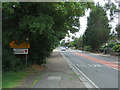
Entering Essex
Looking north on Epping New Road (A104).
Image: © JThomas
Taken: 5 Aug 2017
0.10 miles
3
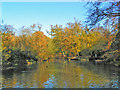
Knighton Woods Pond
Man made pond which was part of the Knighton Estate before being incorporated into Epping Forest
Image: © Brian Gotts
Taken: 14 Nov 2004
0.19 miles
4

Lords Bushes Pond
Pond on the old Knightons estate now part of Epping Forest
Image: © Brian Gotts
Taken: 14 Nov 2004
0.19 miles
6
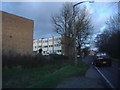
Brook Road, Buckhurst Hill
Overlooking houses on The Cedars
Image: © David Howard
Taken: 5 Jan 2012
0.19 miles
8
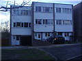
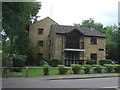
Modern town houses on The Cedars
This style was very popular in the 1960s
Image: © David Howard
Taken: 5 Jan 2012
0.21 miles