
IMAGES TAKEN NEAR TO
Canfield Road, WOODFORD GREEN, IG8 8JH
Introduction
This page details the photographs taken nearby to Canfield Road, IG8 8JH by members of the Geograph project.
The Geograph project started in 2005 with the aim of publishing, organising and preserving representative images for every square kilometre of Great Britain, Ireland and the Isle of Man.

There are currently over 7.5m images from over14,400 individuals and you can help contribute to the project by visiting https://www.geograph.org.uk
Image Map
Images are licensed for reuse under creativecommons.org/licenses/by-sa/2.0
Notes
- Clicking on the map will re-center to the selected point.
- The higher the marker number, the further away the image location is from the centre of the postcode.
Image Listing (15 Images Found)
Images are licensed for reuse under creativecommons.org/licenses/by-sa/2.0
Image
Details
Distance
1
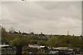
View of the rear of houses on Kensington Drive from Roding Lane North
Kensington Drive is the first turning on the right off Roding Lane North heading towards the A1400 Woodford Avenue after the Wanstead RFC ground. Looking south-southwest.
Image: © Robert Lamb
Taken: 25 Apr 2015
0.10 miles
2
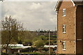
View of the Shard, Walkie Talkie, Gherkin, Heron Tower and Tower 42 from Roding Lane North
Looking west.
Image: © Robert Lamb
Taken: 25 Apr 2015
0.12 miles
3
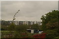
View of blocks of flats in the Orchard Estate off Broadmead Road from Roding Lane North
From left to right, the towerblocks are Liston Way (which also houses the Orchard Children's Centre), Coopersale Close, Blenheim Court, Elizabeth Court, Sunset Court and Lambourne Court. The M11 can just be seen running below and in front of them on a concrete viaduct. Looking west across the allotments on Roding Lane North.
Image: © Robert Lamb
Taken: 25 Apr 2015
0.12 miles
4
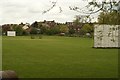
View of houses in Roding Lane North from Salix Lane
Looking north-northeast across the sports field.
Image: © Robert Lamb
Taken: 25 Apr 2015
0.14 miles
5
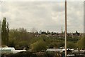
View of the Shard, Walkie Talkie, Gherkin, Heron Tower and Tower 42 from Roding Lane North #2
Looking west-southwest.
Image: © Robert Lamb
Taken: 25 Apr 2015
0.16 miles
6
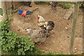
View of chickens in a run in the Redbridge Fishing Lakes
Looking south-southwest.
Image: © Robert Lamb
Taken: 25 Apr 2015
0.18 miles
7
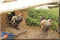
View of chickens in a run in the Redbridge Fishing Lakes #2
Looking west-southwest.
Image: © Robert Lamb
Taken: 25 Apr 2015
0.19 miles
8
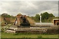
View of a water wheel and fountain in the Redbridge Fishing Lakes
Looking south-southwest.
Image: © Robert Lamb
Taken: 25 Apr 2015
0.19 miles
9
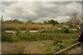
View of a dog looking out over the lake among the reeds in the Redbridge Fishing Lakes
Looking south-southwest.
Image: © Robert Lamb
Taken: 25 Apr 2015
0.20 miles
10
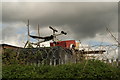
View of a gym bench and trailer on the roof of a container at the rear of Redbridge Garden Centre from Salix Lane
Salix Lane is a privately owned road leading to the Redbridge Fishing Lakes, which have recently opened to all members of the public, not just registered fishermen. Looking north-northwest.
Image: © Robert Lamb
Taken: 25 Apr 2015
0.20 miles