
IMAGES TAKEN NEAR TO
Horns Road, ILFORD, IG6 1DQ
Introduction
This page details the photographs taken nearby to Horns Road, IG6 1DQ by members of the Geograph project.
The Geograph project started in 2005 with the aim of publishing, organising and preserving representative images for every square kilometre of Great Britain, Ireland and the Isle of Man.

There are currently over 7.5m images from over14,400 individuals and you can help contribute to the project by visiting https://www.geograph.org.uk
Image Map
Images are licensed for reuse under creativecommons.org/licenses/by-sa/2.0
Notes
- Clicking on the map will re-center to the selected point.
- The higher the marker number, the further away the image location is from the centre of the postcode.
Image Listing (41 Images Found)
Images are licensed for reuse under creativecommons.org/licenses/by-sa/2.0
Image
Details
Distance
1
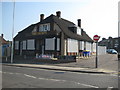
Newbury Park: The former County and former Horns Tavern
A couple of months after Alex took his Image and The County appears to have closed to business. Looking at the closing down party Halloween notices still left outside the pub this probably happened around the end of October 2010.
The pub was on Horns Road. Old Ordnance Survey maps show that this area was originally a linear village known as Ley Street and an older building called the Horns Tavern is shown on the 1896 map. Probably the same building is also shown on the 1864 map but without a name. The building is still shown on the map of 1919, but by 1939 the current building is shown as the Horns Tavern.
Image: © Nigel Cox
Taken: 25 Apr 2011
0.02 miles
3
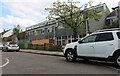
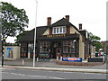
Derelict building on Buntingbridge Road, Newbury Park
It appears to have been the Cranvale residential care home. https://www.cqc.org.uk/location/1-135960167/contact
Image: © David Howard
Taken: 9 May 2021
0.07 miles
4
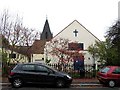
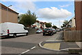
St Laurence, Donington Avenue, Barkingside - Old church
Now the church hall
Image: © John Salmon
Taken: 8 Nov 2004
0.10 miles
6
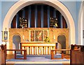
St Laurence, Donington Avenue, Barkingside - Sanctuary
Image: © John Salmon
Taken: 8 Nov 2004
0.11 miles
7

Barkingside: St Laurence Church
The Church has an address on Donington Avenue, but this is the longer Hamilton Avenue side. Although not a listed building the church is interesting architecturally, the foundation stone having been laid in 1939, and showing that just before the Second World War churches were still being built in the same basic style of chancel, nave, tower and steeple that had been in use for centuries. The Ordnance Survey map of 1938 shows an earlier church aligned north-east to south-west and facing onto the parallel road to Hamilton Avenue, Emmott Avenue.
The Church's website is here http://www.stlaurence-barkingside.co.uk/1.5.9/index.php?option=com_content&view=frontpage&Itemid=43
Image: © Nigel Cox
Taken: 25 Apr 2011
0.12 miles
8
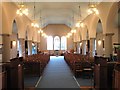
St Laurence, Donington Avenue, Barkingside - West end
Image: © John Salmon
Taken: 8 Nov 2004
0.13 miles
9

St Laurence, Donington Avenue, Barkingside - Font
Image: © John Salmon
Taken: 8 Nov 2004
0.13 miles
10

St Laurence, Donington Avenue, Barkingside - Chancel
Image: © John Salmon
Taken: 8 Nov 2004
0.14 miles