IMAGES TAKEN NEAR TO
Castleton Road, ILFORD, IG3 9QR
Introduction
This page details the photographs taken nearby to Castleton Road, IG3 9QR by members of the Geograph project.
The Geograph project started in 2005 with the aim of publishing, organising and preserving representative images for every square kilometre of Great Britain, Ireland and the Isle of Man.

There are currently over 7.5m images from over14,400 individuals and you can help contribute to the project by visiting https://www.geograph.org.uk
Image Map (Loading...)


Getting Data...Please wait
Leaflet Map data © OpenStreetMap
Images are licensed for reuse under creativecommons.org/licenses/by-sa/2.0
Notes
- Clicking on the map will re-center to the selected point.
- The higher the marker number, the further away the image location is from the centre of the postcode.
Image Listing (72 Images Found)
Images are licensed for reuse under creativecommons.org/licenses/by-sa/2.0
Image
Details
Distance
3
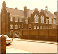
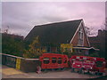
Goodmayes Primary School
Airthrie Road, Goodmayes
Image: © Kenneth Kind
Taken: Unknown
0.10 miles

6
Goodmayes Baptist Church
This church is located on the corner of Kinfauns Road and Goodmayes Lane. View taken looking east.
Image: © Robert Lamb
Taken: 15 Nov 2008
0.11 miles
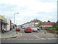
7
Green Lane at the junction of Barley Lane
Image: © David Howard
Taken: 21 Oct 2017
0.12 miles
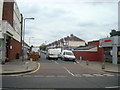
8
Practical Driving Test Centre, Goodmayes
This driving test centre is located at 98 Goodmayes Road IG3 9UZ and carries out practical driving tests for cars and Approved Driving Instructor (ADI) Parts 2 and 3 tests. Candidates for these tests have to park behind the DTC in Kildowan Road.
Image: © David Hillas
Taken: 4 Mar 2024
0.12 miles
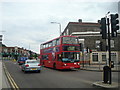
10
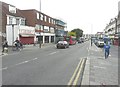
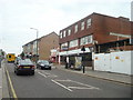
Looking south-southeast along Goodmayes Road
The building, on the left, clad in scaffolding, is numbers 51-53. A description of the work being carried out can be found on Redbridge Council’s website under planning application 2382/10 which states “erection of part two storey, part three storey building with three (A1/A2) units at ground floor. 9 x one bedroom flats at upper floor level. New vehicular access of(f) Kinfauns Road”. Kinfauns Road is the next left beyond the bus.
Image: © John Baker
Taken: 17 Oct 2013
0.12 miles