
IMAGES TAKEN NEAR TO
Bawdsey Avenue, ILFORD, IG2 7TN
Introduction
This page details the photographs taken nearby to Bawdsey Avenue, IG2 7TN by members of the Geograph project.
The Geograph project started in 2005 with the aim of publishing, organising and preserving representative images for every square kilometre of Great Britain, Ireland and the Isle of Man.

There are currently over 7.5m images from over14,400 individuals and you can help contribute to the project by visiting https://www.geograph.org.uk
Image Map
Images are licensed for reuse under creativecommons.org/licenses/by-sa/2.0
Notes
- Clicking on the map will re-center to the selected point.
- The higher the marker number, the further away the image location is from the centre of the postcode.
Image Listing (9 Images Found)
Images are licensed for reuse under creativecommons.org/licenses/by-sa/2.0
Image
Details
Distance
2
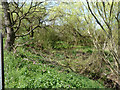
Seven Kings Water north of A12
Somewhere down there among the general wetness is a stream. I think its waters join the Mayes Brook before reaching the Thames.
Image: © Robin Webster
Taken: 9 Apr 2011
0.16 miles
3
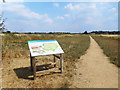
Fairlop Quarry Nature Reserve
A large area of old sand and gravel quarry works has been left to go back to nature. The track shown here goes around the edge.
Image: © Des Blenkinsopp
Taken: 21 Jul 2018
0.17 miles
4
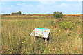
Fairlop Quarry Nature Reserve
A large expanse of old sand and gravel quarries has been left to return to nature.
Image: © Des Blenkinsopp
Taken: 21 Jul 2018
0.21 miles
5
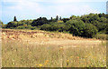
Old Sand Pit, Fairlop Quarry Reserve
Part of a former sand and gravel quarry which is now a nature reserve.
Image: © Des Blenkinsopp
Taken: 21 Jul 2018
0.21 miles
6
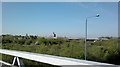
View of King George Hospital from the footbridge over the A12 at Little Heath
Looking south-southwest.
Image: © Robert Lamb
Taken: 22 Apr 2015
0.24 miles
7
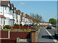
Bypass architecture
It seems folly now to line a new dual carriageway with housing like this, but it was quite the usual thing in the 1930s. Admittedly they have rear access for cars, but nobody seems to want to keep their cars there now. Bay windows and mock Tudor were very popular then as well.
Image: © Robin Webster
Taken: 9 Apr 2011
0.24 miles
9
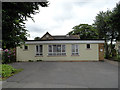
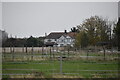
Church Halls Aldborough Hatch
The flat roofed building at the front is a church hall built in the middle of the 20th century.The pitch roofed building behind was the church school built in 1867. It ceased to be a school in 1912 and is now used as a church hall. It is locally listed.
Image: © Phil Gaskin
Taken: 17 Jul 2012
0.25 miles