
IMAGES TAKEN NEAR TO
Perrymans Farm Road, ILFORD, IG2 7LX
Introduction
This page details the photographs taken nearby to Perrymans Farm Road, IG2 7LX by members of the Geograph project.
The Geograph project started in 2005 with the aim of publishing, organising and preserving representative images for every square kilometre of Great Britain, Ireland and the Isle of Man.

There are currently over 7.5m images from over14,400 individuals and you can help contribute to the project by visiting https://www.geograph.org.uk
Image Map
Images are licensed for reuse under creativecommons.org/licenses/by-sa/2.0
Notes
- Clicking on the map will re-center to the selected point.
- The higher the marker number, the further away the image location is from the centre of the postcode.
Image Listing (127 Images Found)
Images are licensed for reuse under creativecommons.org/licenses/by-sa/2.0
Image
Details
Distance
1

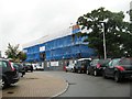
View of the Barkingside Progressive Synagogue from Perrymans Farm Road
Looking south-southwest.
Image: © Robert Lamb
Taken: 7 Oct 2013
0.01 miles
2
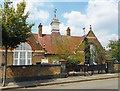
School to Synagogue to Islamic Centre
It still says Infants School on the gate, but this building in Ferrymans Farm Road was a synagogue when this picture was taken in 2013 Image
The Jewish star is still on the top of the weather vane but the notice by the door says it's an Islamic Centre now.
Image: © Des Blenkinsopp
Taken: 21 Jul 2018
0.02 miles
3
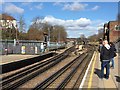
On Newbury Park Station
Standing on the Central Line westbound platform looking north towards the bridge which carries Ferrymans Farm Road over the railway.
Image: © Trevor Harris
Taken: 1 Mar 2020
0.05 miles
7
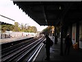
Looking north up the Central line tracks from Newbury Park station
It looks quite peaceful, but I can assure you it isn't! This scene is buzzing with the constant roar of traffic from the A12 Eastern Avenue behind, King George Avenue behind the railings to the left and of course Central line trains! This is the view looking north up the Central line tracks from the westbound platform at Newbury Park. The bridge in the background carries Perryman's Farm Road.
Image: © Robert Lamb
Taken: 3 Nov 2010
0.06 miles
9
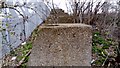
View of the World War II tank traps next to the Central line tracks on Footpath 97
Looking north-northwest, towards Barkingside.
Image: © Robert Lamb
Taken: 6 Mar 2018
0.09 miles
10
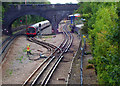
Central line train
Coming out of Newbury Park Station
Image: © John Myers
Taken: 14 Sep 2009
0.09 miles