
IMAGES TAKEN NEAR TO
Raymond Road, ILFORD, IG2 7EA
Introduction
This page details the photographs taken nearby to Raymond Road, IG2 7EA by members of the Geograph project.
The Geograph project started in 2005 with the aim of publishing, organising and preserving representative images for every square kilometre of Great Britain, Ireland and the Isle of Man.

There are currently over 7.5m images from over14,400 individuals and you can help contribute to the project by visiting https://www.geograph.org.uk
Image Map
Images are licensed for reuse under creativecommons.org/licenses/by-sa/2.0
Notes
- Clicking on the map will re-center to the selected point.
- The higher the marker number, the further away the image location is from the centre of the postcode.
Image Listing (43 Images Found)
Images are licensed for reuse under creativecommons.org/licenses/by-sa/2.0
Image
Details
Distance
1
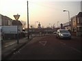
Ward's Road, Newbury Park
I can't think of a single reason a perfectly safe straight road had these barriers the whole length of it. All it takes is one person to try and get past before their turn and you will have a major head on collision.
Image: © David Howard
Taken: 31 Jan 2012
0.05 miles
2
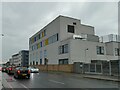
Seven Kings Primary School, Ley Street
Eleven years ago there was a former trolleybus depot on the site Image Redevelopment of the site started in 2014 Image
Image: © Stephen Craven
Taken: 30 May 2022
0.06 miles
3
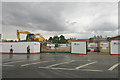
Site of former trolleybus depot, Ley Street, Ilford
Demolition of the former depot began in June 2014. How it used to look in the years before the work began can be seen at Image and Image
Image: © David Kemp
Taken: 8 Jul 2014
0.06 miles
4
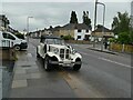
Classic car on Wards Road
A 'Beauford Series 3' probably used as a wedding car.
Image: © Stephen Craven
Taken: 30 May 2022
0.06 miles
5
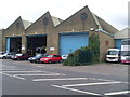
Former Trolleybus Depot, Ilford (1)
Situated in Ley Street near Perth Road, this depot dates from early 1903 when it operated trams which were replaced by trolleybuses in February 1938. Subsequently, the trolleybuses were replaced by motorbuses in 1959, they being allocated to Barking and Seven Kings garages nearby and the Ilford trolleybus depot closed. Update:this former trolleybus depot was demolished in May 2014.
Image: © David Hillas
Taken: 7 Sep 2011
0.07 miles
6
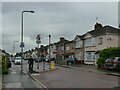
Road narrowing, Wards Road
A restriction giving priority to westbound traffic, with an eastbound cycle bypass.
Image: © Stephen Craven
Taken: 30 May 2022
0.07 miles
7
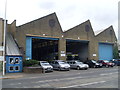
Former Trolleybus Depot, Ilford (2)
This depot in Ley Street operated trolleybuses on local routes 691 and 693 from 1938 to August 1959. From late 1941 to June 1943, the depot received 43 trolleybuses that were originally due to be exported to South Africa to run in Durban and Johannesburg, but the Second World War prevented this. Following trolleybus conversion to motorbuses on the 18th August 1959, this depot was closed and is now used for storing vehicles belonging to the London Borough of Redbridge. Its postcode is IG2 7QZ. Update: this former trolleybus depot was demolished in May 2014.
Image: © David Hillas
Taken: 7 Sep 2011
0.07 miles
9
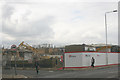
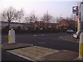
Corner of Perth Road & Ley Street, Ilford
This corner was until June 2014 occupied by the buildings of the former Ilford trolleybus depot. More detail can be found at Image and Image
Image: © David Kemp
Taken: 8 Jul 2014
0.08 miles
10
Ley Street, Newbury Park
At the junction of Ward's Road
Image: © David Howard
Taken: 31 Jan 2012
0.08 miles