IMAGES TAKEN NEAR TO
Wayside Mews, ILFORD, IG2 6JU
Introduction
This page details the photographs taken nearby to Wayside Mews, IG2 6JU by members of the Geograph project.
The Geograph project started in 2005 with the aim of publishing, organising and preserving representative images for every square kilometre of Great Britain, Ireland and the Isle of Man.

There are currently over 7.5m images from over14,400 individuals and you can help contribute to the project by visiting https://www.geograph.org.uk
Image Map
Images are licensed for reuse under creativecommons.org/licenses/by-sa/2.0
Notes
- Clicking on the map will re-center to the selected point.
- The higher the marker number, the further away the image location is from the centre of the postcode.
Image Listing (86 Images Found)
Images are licensed for reuse under creativecommons.org/licenses/by-sa/2.0
Image
Details
Distance
3
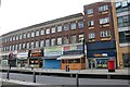
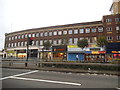
Shops on Eastern Avenue, Gants Hill
Here's an earlier view https://www.geograph.org.uk/photo/5539308
Image: © David Howard
Taken: 6 Jun 2021
0.06 miles
6

Sunset over Eastern Avenue, Gants Hill
I've never seen a sunset divided into layers, the yellow part covered the entire view of the horizon followed by the others. It was only visible looking due west.
Image: © David Howard
Taken: 13 Apr 2025
0.07 miles
7
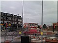
Gants Hill Roadworks
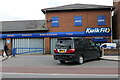
Gants Hill Roundabout has been receiving a facelift since the beginning of the year and this is the progress as of Tuesday. The road has been completely resurfaced, which has led to Cranbrook Road (the road in the distance) and Woodford Avenue (out of shot to the right) being closed in both directions by the shops on either side of the roundabout. The subways to Gants Hill tube station have received new wall tiling (although this has been rather piecemeal and has merely involved a new line of brightly coloured tiles by each of the exits) as well as new floor tiling. Traffic signals have been installed at each junction leading to the roundabout, but are not yet operational, and new high-mast streetlighting (the column by the red van is one of the installations) has also been installed, replacing the older street lights seen behind it. View taken looking southwest from Cranbrook Road North.
Image: © Robert Lamb
Taken: 27 Jul 2010
0.07 miles
8
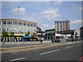
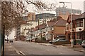
Woodford Avenue, Gants Hill
The approach to Gants Hill roundabout (built over the Underground station), where the A1400 Woodford Avenue meets the A12 Eastern Avenue and the rather less important A123. Like many suburban Underground stations, Gants Hill has become the focal point for a suburban shopping centre.
Image: © Richard Vince
Taken: 13 Jul 2013
0.07 miles